UPDATED 10.20am: There is a severe weather watch for heavy rain issued by Metservice for Auckland, Great Barrier, Coromandel Peninsula and the Western Bay of Plenty, valid until 9.46pm today. A heavy rain warning has been issued for Girsborne.
The Ngamuwahine in flood this morning. Photo: Alice Campbell.
The watch affects Coromandel Peninsula and Bay of Plenty north west of Tauranga: Through to Sunday night with 100mm possible in 24 hours.
Auckland, mainly north of the city and Great Barrier Island through to late Sunday morning with 70mm of rain possible in 12 hours. Isolated thunderstorms Sunday afternoon and early evening could also produce localised heavy rain.
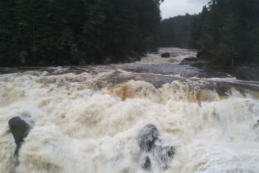
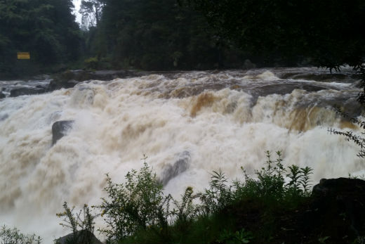 McLaren Falls today. Photo: Alice Campbell.
People are advised to keep up to date with forecasts in case part of this watch is upgraded to warning.
A complex low lies slow-moving to the west of northern New Zealand. An associated trough moves southwards across the upper North Island during Sunday, bringing widespread rain with some heavy falls.
At 10am Metservice issued a heavy rain warning for Gisborne.
Rain is expected to become heavy tonight. In the 30 hours from midnight Sunday to 6am Tuesday, 120 to 140mm is forecast to accumulate in the hills and ranges of Gisborne with lesser amounts down to sea level. Heaviest falls are expected north of Tologa Bay. Rainfall rates of 15 to 20mm per hour possible.
A trough is moving slowly southwards over the upper North Island preceded by easterly winds and a band of rain. Rain is expected to become heavy over the Gisborne region tonight and continue into Tuesday morning. During this time 140mm of rain may accumulate about the hills and ranges of Gisborne, particularly north of Tologa Bay. The heavy rain is expected to cause streams and rivers to rise rapidly and may cause slips and surface flooding.

0 comments
Leave a Comment
You must be logged in to make a comment.