Batten down the hatches as the MetService has issued a severe weather warning for the Bay of Plenty and Waikato.
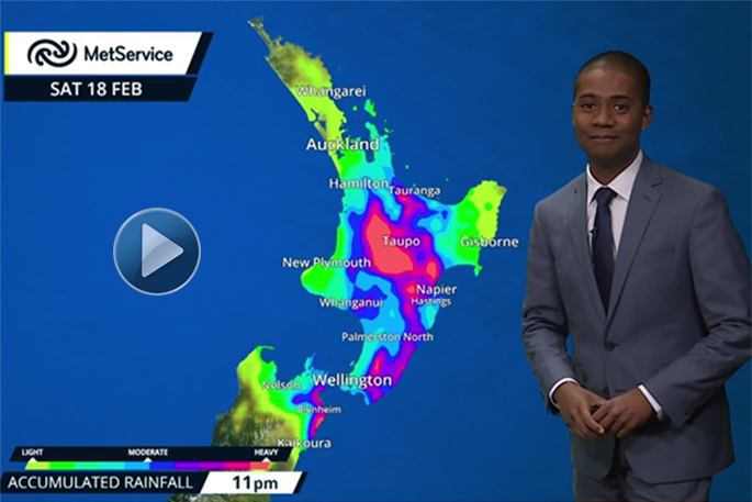
Further significant heavy rain and isolated thunderstorms are anticipated this afternoon and Saturday, with the heaviest falls expected about the Eastern Waikato, Taupo, and Western Bay.
The cruddy weather is being caused by a trough of low pressure over the North Island, which is expected to extend down to central New Zealand today and then become slow moving during the weekend and gradually weaken.
'In the 36 hours from 9am Friday to 9pm Saturday, expect 100 to 140mm on top of what has already fallen.
'Rainfall intensities may reach 15 to 25mm per hour at times with localised downpours of 25 to 40mm per hour possible in any thunderstorms, especially this afternoon and again Saturday afternoon.”
MetService warns this amount of rain will cause rivers and streams to rise rapidly and may lead to surface flooding and slips.
Severe weather watches and warnings have been issued for the majority of the North Island.
The New Zealand Transport Agency is urging all road users to take extra care this weekend and check the latest conditions in both the Bay of Plenty and Waikato.
NZTA Journey Manager Liam Ryan says with all this rain people may see some flooding or slips and they should take extra care.
'All people who are using the roads should reduce their speed and increase their following distances.
'As conditions can change rapidly, check the latest weather and road updates before you head out.”
Keep up to date with the latest forecasts and any watches/warnings at metservice.com or on mobile devices at m.metservice.com.
You can also follow updates on MetService TV, on Facebook, @metservice and @MetServiceWARN on Twitter and at blog.metservice.com

0 comments
Leave a Comment
You must be logged in to make a comment.