
A ridge of high pressure covers northern and central New Zealand on Friday, bringing fine weather to the top half of the country.
Meanwhile, a weakening front is forecast to cross the lower South Island late Friday bringing a period of rain or showers to the area, says the MetService.
Some brief heavy falls are possible in Fiordland, however, amounts are not expected to reach warning criteria.
'The weak front should then die away as it crosses central New Zealand on Saturday followed by another ridge of high pressure which persists through the weekend.
'Finally, another front is expected to approach southern New Zealand on Monday, preceded by a strengthening northwest flow over the South Island.”
Relief has finally arrived to those areas of the North Island which have seen flooding rainfalls over the last week. 'Many parts of the upper North Island have received 200 to 300mm of rain and more over the last seven days,” says MetService Meteorologist Heath Gullery.
'A large high in the Tasman Sea brings fine weather across most of New Zealand this week."
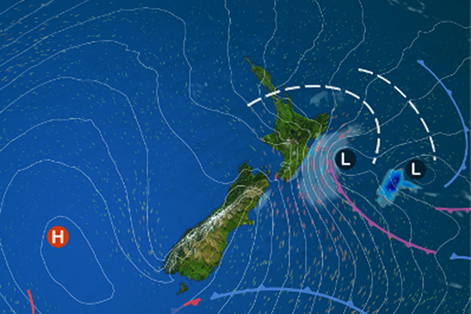
This high persists over New Zealand through to the weekend, with only a brief interruption late Friday and Saturday as a weak front brings some showers to southern and eastern areas.
'As the high spreads across the country, we can expect a return to autumnal temperatures, with cooler nights and warm days,” says Heath.
'The high is going to bring some welcome relief to much of the North Island this week, meaning folks in the upper North Island who have taken the brunt of the recent bad weather can now focus on the clean-up without the threat of further inclement weather.”

0 comments
Leave a Comment
You must be logged in to make a comment.