Now that the country has been sitting under a ridge of high pressure and enjoying settled weather, you could be forgiven for forgetting the showery start to the week.
On Monday, the North Island saw heavy showers and isolated thunderstorms as a low moved over the country, a site near Tolaga Bay reported a downpour of 25mm in one hour late afternoon.
After the low, a slow-moving ridge built over the country and it's 'cloak of good weather” has remained for the majority of New Zealand through to today.
'With such a wet start to April the fine weather and very low rainfall accumulations, I'm sure has come as a relief to many,” says a MetService meteorologist.
'Lasts week has seen a more ‘normal' weather pattern for April though the country has escaped a typical cold outbreak from the south so far this month. Average to above average maximum temperatures are expected to last into next week which will please New Zealander's enjoying warm daytime temperatures.”
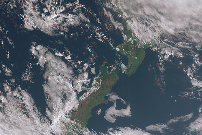
The only current system of note is a sub-tropical low that passes to the northeast of the country from today to Thursday generating moderate east to southeast swell for the North Island's eastern coasts.
'ANZAC Day will be dry for most with only those in the east of the North Island forecast showers in the southeast flow.
'Low cloud is predicted for the dawn services in Canterbury, setting a somber mood.”
Conditions also look dry and generally fine for those competing or watching the World Masters Games in Auckland until Friday.

0 comments
Leave a Comment
You must be logged in to make a comment.