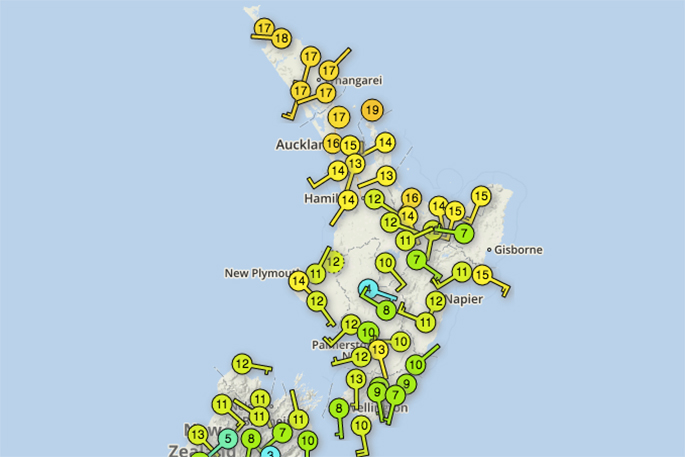
It seems Autumn has woken from its slumber with many places experiencing colder temperatures today.
Northern New Zealand has also noticed the colder change, says WeatherWatch.co.nz.
'While still fairly mild with temperatures already in the mid-teens in many places, the air is much cooler than the previous sub-tropical airflows of recent weeks.
'Tonight will be another cold night, perhaps colder for some northerners as high pressure increases and winds ease there too,” says the weather organisation.
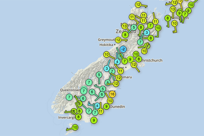
'Frosts are possible tonight mainly through inland areas of both islands in the usual more frost-prone areas. Heavy frosts are not forecast at this stage.”
By Wednesday many places will be warm as westerlies kick back in ahead of the next cold snap. Places in the east may climb back into the low 20s for a short time - before being blasted by the southerly.
NEXT COLD BLAST(S) Over this Thursday and Friday what appears to be a larger cold blast will move in nationwide.
Again it's short lived with a high coming in behind it but this may produce heavier frosts afterwards and also deliver snow into the North Island ranges.
There may be yet a third cold southerly again next week too.
It seems Autumn has finally woken up.

0 comments
Leave a Comment
You must be logged in to make a comment.