A total of 36 weather-related calls kept firefighters, mostly in the Bay of Plenty, busy from 6pm on Thursday and early Friday.
Northern Fire Communications shift manager Jaron Phillips says the calls included trees across roads, a couple of roofs lifting off and a home in Taupo which was flooded through the roof.
There were also reports of a tree blocking SH33, near Okere Falls, and a slip on the road between Whakatane and Ohope.
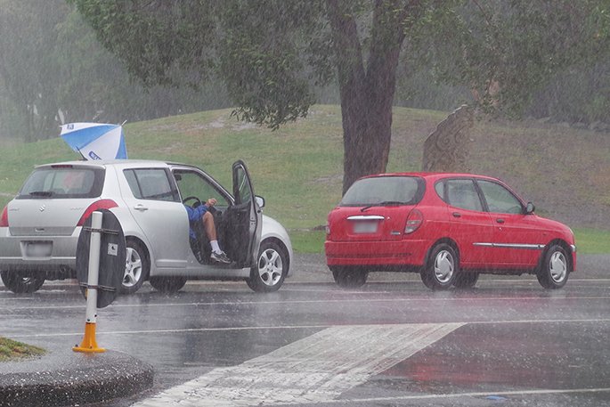
Around 5.30am on Friday, firefighters were called to an incident where a tree had fallen on a car on Highway 22, near Pukekawa in northern Waikato.
Early reports indicated the driver managed to get out of the car but had minor injuries.
During the 18 hours to 5am Friday, most of the Bay of Plenty, Rotorua and eastern Waikato had between 50mm and 100mm of rain.
The highest amount recorded was 140mm at a station in eastern Bay of Plenty.
"The rain has eased over most of the North Island," says MetService meteorologist Nick Zachar.
But showers were still expected to be frequent and some would he heavy.
"We're seeing a few pops of lightning across Northland and Auckland north of the city." Thunderstorms were possible in the upper half of the North Island but would be "few and far between".
Early on Friday, there were also strong to gale northwesterlies across the upper North Island, and severe gales were possible in Wellington and Wairarapa through Friday, easing by the evening.
"Rain is going to continue across parts of Wellington and Kapiti and a bit further north, but nothing as severe as we're going to see in the South Island.”
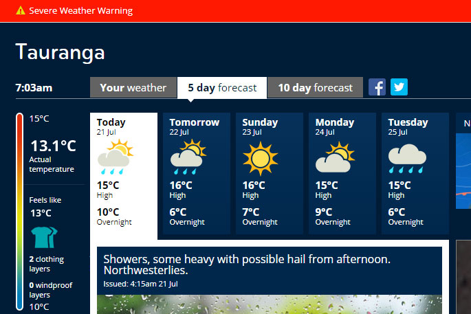
According to the MetService, some heavy shower and possible rain is expected to hit the Bay of Plenty this afternoon.
A severe weather warning remains in place for the region, but is expected to be updated around 9am.
-Addition reporting Stuff.co.nz

0 comments
Leave a Comment
You must be logged in to make a comment.