Thunderstorms are once again bubbling up across the North Island with downpours and storms today drifting into more western areas after yesterday drifting east.
Heavy downpours with thunderstorms are now forming around Taranaki, says WeatherWatch.co.nz.
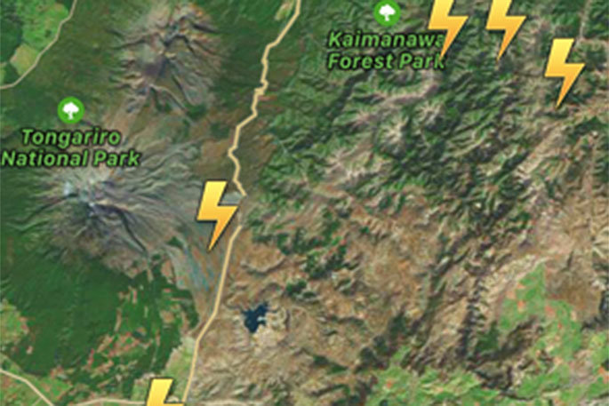
'The majority of thunderstorms are around Central Plateau and State Highway One, The Desert Road, where WeatherWatch.co.nz advises motorists take extreme care in very heavy downpours which may cause surface and flash flooding, also hail.
'Thunderstorms are also growing and forming along the Ruahine and Tararua Ranges.
'Storms will continue to grow until mid to late afternoon in the North Island while in the South Island thunderstorms may form in the northern mountains this afternoon, while downpours could flare up until this evening elsewhere, as far south as Central Otago.”
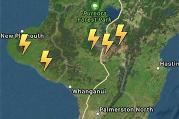
Where the main storm cells currently lie, with active and developing thunderstorms from the Tararua's, to Central Plateau to Taranaki.
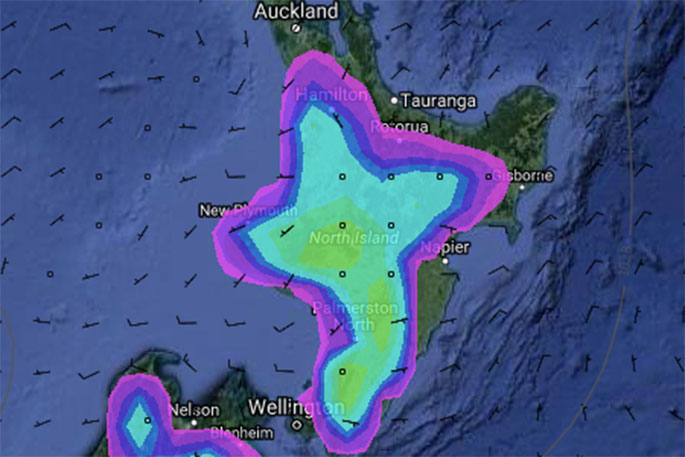
Forecast Rain Radar for 4pm shows the areas most at risk from downpours - however coastal areas may remain completely dry in many places near these downpours.

0 comments
Leave a Comment
You must be logged in to make a comment.