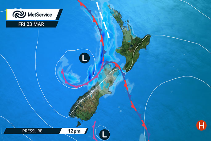
A cold front is stalled over central New Zealand today, wedged between high pressure to the north and to the southwest.
Cooler temperatures and rain persist for central regions into Friday morning, before affecting the rest of the country late Friday into Saturday.
'Heavy rain is associated with the front over central New Zealand today and a strong, cool southerly continues to feed moisture into the east coast of the South Island, continuing the rain there until evening,” says MetService meteorologist Ciaran Doolin.
'There is a Severe Weather Warning for heavy rain for northwest Nelson and northern Buller, and a Watch for Kapiti, Wellington and Marlborough north of Cape Campbell.
'Over the northern North Island cloudy periods and isolated showers are the order of the day for many. Most showers should avoid central Auckland which is good news for cricket fans heading to the Black Caps vs England at Eden Park today."
Fine weather is expected to emerge during Sunday for most of the country, apart from some remaining showers in the northeast and west.
The fine weather for most should continue into early next week.
'The front currently affecting central New Zealand brought cold air over the South Island yesterday, plunging many places into single digits overnight and lowering snow to 1000m.
"Highs today will be in the early teens for most, which sits in stark contrast to earlier in the week where some areas reached 30 degrees. The northern North Island on the other hand remains under the same air mass as the last few days, with highs in the 20s continuing through the next few days.
"Temperatures will gradually recover over the South Island through the weekend but there are a few chilly days and nights in store."

0 comments
Leave a Comment
You must be logged in to make a comment.