High pressure is on the way and it will do two things to our temperatures.
Firstly, it will drop them. Secondly, it will help create warmer than average airflows from the sub-tropics later this weekend and next week.
WeatherWatch.co.nz says New Zealand is having a winter with more southerlies than previous years but that by the end of this week, and potentially through next week for some regions, winds are likely to come from the northerly quarter (NW, N and NE).
Great #hail in #Aongatete BoP just now @sunlive_nz @PhilipDuncan @WeatherWatchNZ @MetService pic.twitter.com/0qaCGW8Y7g
— Ben Haarmann (@waihisurfie) July 10, 2018
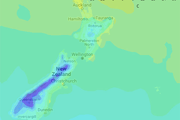
"Overnight lows this weekend, or early next week, will be in (or close to) double digits for a number of main centres in the North Island, like Wellington, Hamilton, Tauranga, Auckland and Napier to name a handful.
"The South Island will also be warmer than average from this weekend but the rest of the week ahead does look cold."
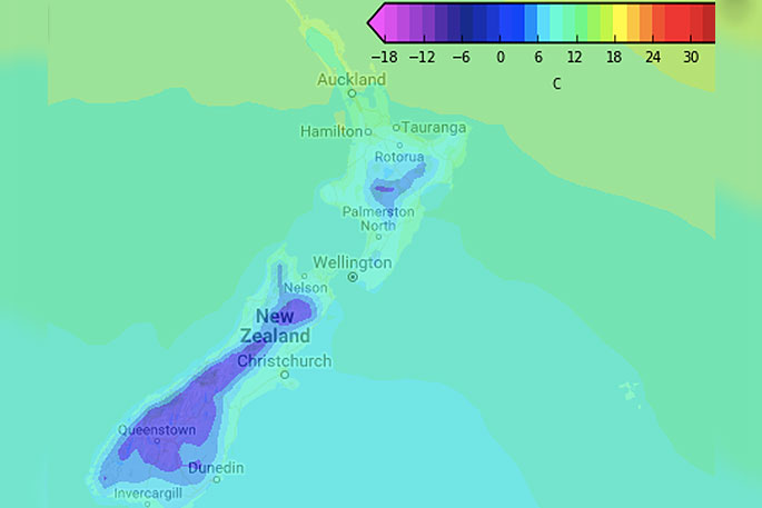
Overnight lows in Central Otago may drop to -6 this Thursday morning with cold days and nights for a big chunk of the South Island for the rest of this week.
However, by the weekend Christchurch has overnight lows of around +8 degrees and daytime highs lift next week.
Daytime highs this weekend in the east of the North Island and again early next week (also in the upper North Island) will reach the 17 to 20 degree mark, maybe even in to the low 20s if the sun combines with this air flow.
Heavy rain and thick cloud cover will eventually accompany this nor'easter and that will limit daytime heating but will help keep the nights milder.
There is no sign of a major cool down next week, in fact mild nor'westers may continue for many (yet to be locked in, confidence levels now over 50%).

0 comments
Leave a Comment
You must be logged in to make a comment.