
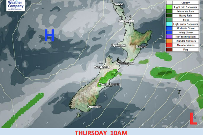
Large highs outside of the hot summer months can often drag in something gloomy - low cloud that blocks the sun, says WeatherWatch.co.nz.
It's referred to as "anti-cyclonic gloom" and is simply low cloud trapped under a high (cool nights and mild sea temperatures can help make the blanket of cloud, which can also include drizzle patches).
"This weather often affects the coastal areas of the south and west of New Zealand - but can affect any coastal area. Those further inland tend to be sunny at the same time.
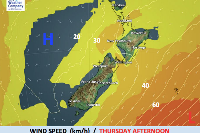
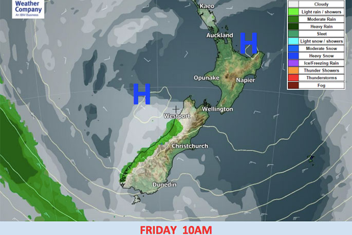
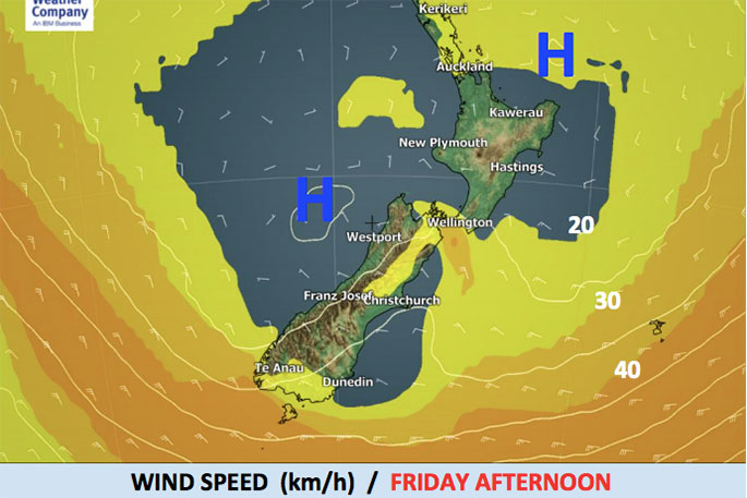
"As the large high transfers from being Tasman Sea centred to Pacific Ocean centred it will shift windflows in New Zealand, even if only light - meaning Friday will be sunny and warmer in many places that have been cloudy in recent days," says the weather organisation.
The maps below indicate where clouds will likely be today and tomorrow...
Friday/Weekend: Highs into the mid 20s C possible, colder than normal nights remain for some
Some of the hottest days since last summer are now on the way with highs on Friday and this weekend forecast to reach the mid-20s, according to WeatherWatch.co.nz.
Central Otago - which a week ago was dealing with snow to 200m - has highs of 24 degrees forecast over the coming days, with a week of temperatures in the low to mid 20s on the way.
Lumsden in Northern Southland had a forecast high of only 4 degrees with a snow/rain mix last Friday, but this Friday is forecast to be fairly sunny with a high around 20 degrees and highs in the mid 20s by early next week.
Friday looks sunny and warm in a number of main centres like Christchurch, Nelson and Blenheim with highs in the low to mid 20s.
Dunedin is a little cooler but still has a high of 18 with 20 possible inland.
The eastern North Island will be the warmest northern region with Hawke's Bay expected to reach 24 degrees on Friday but it will be after a colder than average night, where lows may drop near freezing (+2C).
The western North Island, like Taranaki, has normal overnight lows for the most part but the daytime highs will continue to grow warmer than average.
Some northern areas will also be colder than normal tonight and Friday morning but warmer than average days are coming in, despite main centres like Auckland and Hamilton dealing with plenty of anti-cyclonic gloom this week, which has stunted daytime highs.
Auckland and Hamilton will both be colder than average on Friday morning but then finally warmer than average by Friday afternoon.
The weekend looks warmer than this week has been.

0 comments
Leave a Comment
You must be logged in to make a comment.