November has seen hundreds of thunderstorms across New Zealand and the start of summer on the meteorological calender is no different.
December is set to start with tropical northerlies bringing moisture down over New Zealand with extra tropical heat and then when combined with our local daytime heating inland it's the perfect recipe for big cloud build ups, downpours and thunderstorms in the afternoon or evenings.
"This is normal weather for this time of the year as true summer starts to move in (usually kicking in properly by January)," says WeatherWatch.co.nz
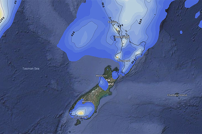
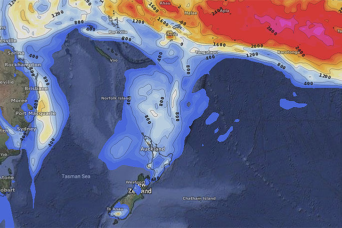
"November's last day will have inland downpours in both islands, then by Sunday December 2nd we'll be seeing a burst of tropical energy brought in by the weakening large Tasman Sea low with significant downpours (seen in these maps below which show potential for thunderstorms -- blue is some risk, yellow/orange is high risk. Localised flooding is also possible in these high risk pockets (which may move a little between today and when they bubble up, due to slightly shifting wind flows)."
These downpours and thunderstorms will flare up for the next four days then ease back around Tuesday and Wednesday next week as a more refreshing westerly moves in.

0 comments
Leave a Comment
You must be logged in to make a comment.