MetService weather maps have shown a few, almost stationary features currently around New Zealand, a low to the west and a ridge to the southeast.
This means we will have very similar weather days as we head into the weekend.
As the low slowly fills, another ridge moves over the country from the southwest during Saturday and Sunday.
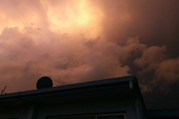
'All the ingredients are in place for some significant afternoon thunderstorms over inland parts of both islands for the next few days,” says Meteorologist Rob Kerr.
'With northerlies pushing warmer, moisture laden air over the country close to the surface, and a cold pool in the upper atmosphere causing enough instability for severe thunderstorms to develop.
'As a result, MetService currently has a Severe Thunderstorm Risk areas for parts of both islands during Friday.
'Any region covered by a thunderstorm risk should prepare for localised downpours.
The ridge of high pressure moving over the South Island on Saturday and the North Island on Sunday does not flush out the low-level moisture, but it will shut off the most vigorous shower activity by putting a cap on how high the air can lift.
'We will continue the theme of low level stratus cloud in the mornings followed by bubbly cumulus cloud and even showers for some places, but the chance of thunderstorms decreases as the ridge spreads northeast,” says Rob.
A notable exception from the shower activity this weekend will be the Summer's first home cricket test at the Basin Reserve, as the Black Caps face Sri Lanka under cloudy skies in the Capital Saturday morning, with more blue sky appearing as the day goes by.
As we head towards Christmas and many people are making plans for the holidays, MetService are urging people to stay up to date with the latest information at www.MetService.com or have their free MetService App handy.
There is now a Severe Thunderstorm Watch in place. This Watch covers much of the North Island, and inland upper South Island. Details: https://t.co/GZIq9Jlbrw Warnings for storms may be issued later, so keep up to date and stay safe! ^RK pic.twitter.com/oN5SY4PXxu
— MetService (@MetService) December 13, 2018

0 comments
Leave a Comment
You must be logged in to make a comment.