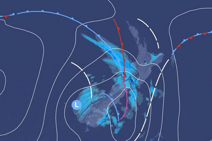
Wet weather to finish off the week as an active frontal system makes its way over the South Island today.
'Many areas are going to see wet weather today as this system moves over the country," says MetService meteorologist Mark Bowe.
The rain will come as a cool change to some of the high temperatures we have seen across the country over the last few days.
'Napier got to 33°C on Saturday which is very close to the highest January temperature on record for that area."
The ridge of high pressure partly responsible for these temperatures is moving off to the east today. This makes way for an active weather system which will cool down the high temperatures we have seen across the country this past week.
'Many people have had warm and muggy nights but that should come an end as this week concludes."
The main North Island centers such as Auckland and Wellington have all seen temperatures higher than normal January averages.
Some of South Island towns have also seen temperatures reach higher than average at times during the past week.
'The southwest change will cool temperatures down a little as the wet weather moves across the country today and into early next week."
This week finishes as next week is due to start - with wet weather, particularly for the North Island, forecast for early Monday.
'Plenty to keep an eye on as changeable weather is expected for early next week."

0 comments
Leave a Comment
You must be logged in to make a comment.