People are being warned to be prepared for some changeable forecasts over the next 10 days if you live in the North Island of New Zealand, as Cyclone Oma continues to churn away.
The very slow moving Category 2 Tropical Cyclone remains west of Vanuatu and will spend the next few days tracking towards north west New Caledonia an then the open waters of the Coral Sea.
WeatherWatch.co.nz says there is better news for Vanuatu and New Caledonia today with latest modelling and tracking all indicating Oma will pull just a little further west in the days ahead.
"This is a big positive as it takes the storm further away from these places with fairly normal weather resuming for many main centres.
"The negative is that Oma will track further over the open waters of the Coral Sea and latest modelling that WeatherWatch.co.nz trusts strongly suggests the tropical storm will strengthen this weekend and next week and may well grow into a "severe" Category 3 storm, or even higher."
However Oma, which is dutch for 'Grandmother', will be very slowly moving and will take her time. One week in fact. The latest is that it will take over a week to track slowly across the Coral Sea. This means even a week from now the storm may still be well away from NZ - so how might it affect us?
WeatherWatch.co.nz says OMA may connect with a cold front moving up New Zealand at the end of next week to create a small area of low pressure (known as a trough) around northern NZ. Basically this acts as a bit of a link from that NZ cold front, to the tropical storm and it helps feed bigger rain clouds - this is definitely not a storm, it's a rain event only.
The future of OMA beyond 7 days is unknown - it could brush Australia, it might make landfall in Australia (not currently expected), it may fall apart at sea, it may track just north of NZ as a weaker low, or the low may even reach NZ (not looking likely at this stage).
It's too far out to lock in - but the latest data does suggest it may influence rain clouds in the New Zealand area next weekend which would be great news for a lot of farmers and growers - not so great for all the outdoor events and festivals coming up adding some uncertainty there - so we'll keep you posted as best we can next week.
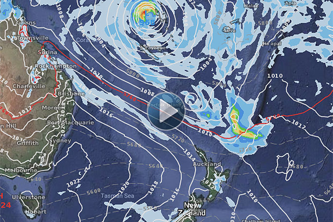
 - NEXT TUESDAY FEB 19.
CHANGEABLE FORECASTS
With such a big tropical storm on our doorstep it makes sense that it could influence our weather, even if the storm itself is not currently forecast to directly hit New Zealand.
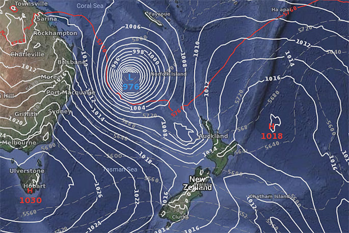
In a week there will be a very large high over Tasmania which could weaken Oma, or guide Oma in a new direction.
So right there are two moving parts already, but then add on top of that a cold front coming in to the New Zealand area which could connect up with the tropics and create bigger rain clouds and a trough over northern New Zealand. Or, will the high will win and stop that from happening?
"With so many moving parts this is why the forecasts are flip flopping for some places.
"We think by this Sunday or Monday most forecasts will be starting to lock in what is most likely to happen and certainly across next week we'll be tracking any chances for rain - which is now desperately needed in a number of regions across the country."
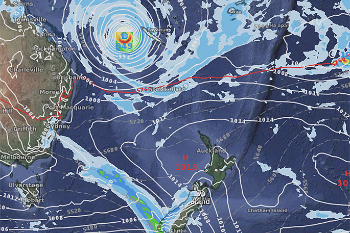
 - NEXT FRIDAY FEB 22.

1 comment
fingerprint
Posted on 15-02-2019 11:25 | By foruandme
quite a large fingerprint hopefully it stays out in the ocean.
Leave a Comment
You must be logged in to make a comment.