A large high shaped like an Easter Egg will spread across New Zealand next week with a cold start but a settled rest of the week may well linger into Easter weekend itself, says WeatherWatch.co.nz.
The anticyclone (also known as a high) will be reaching New Zealand around Monday and will initially bring cold southerlies into both islands with showers, which clear from the south on Monday.
By Wednesday (a week from today) it's expected this large anticyclone will be crossing over the country and may then bring three or four days of dry, calm, weather to most of the country.
"While it's too early to lock in the full Easter weekend forecast (which is still over 8 days from now) this high is likely to be slowly departing our shores around then which may mean a mild long weekend as northerlies develop - but it also means there may be an increased chance of wetter weather towards Easter Monday. We hope to bring you a more firmed up Easter forecast by this coming Sunday.
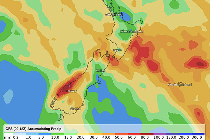
"In the meantime, if you're someone wanting more rain this forecast may not be the best. While we do have some rain in both islands coming between today and next Monday, much of next week then looks dry and potentially so too does Easter Weekend over much of NZ - we'll confirm more this weekend."
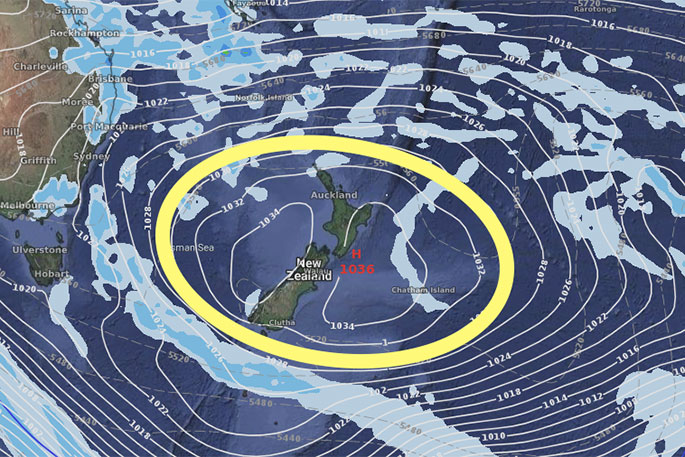
AIR PRESSURE MAP FOR GOOD FRIDAY (APRIL 19). Please note, this may change between now and then but large highs aren't known for quickly disappearing - so there's a fairly moderate to high chance this high will linger into the start of Easter... but please note WeatherWatch.co.nz won't be confirming an Easter forecast until this coming Sunday.

0 comments
Leave a Comment
You must be logged in to make a comment.