A high pressure dominates New Zealand's weather early this week. but will drift eastwards later in the week, allowing a couple of fronts to move over the country.
Temperatures this week are expected to be warmer than average in most places due to a dominant north to northeast flow, which drags warmer air from the north over the country.
In particular, the West Coast of the South Island is forecast to be about 5 degrees warmer than normal on Monday and Tuesday.
'The average maximum temperatures for May along the West Coast are around 14 to 15 degrees and early this week they are likely to see maximums of around 19 or 20 degrees,” says MetService Meteorologist Stephen Glassey.
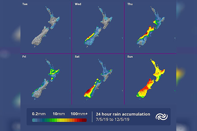
The high pressure moves away to the east on Wednesday and the first of two fronts brings a period of rain to the north and west of the South Island on Wednesday and Thursday, before it weakens over the North Island on Friday. A second front looks likely to bring rain to much of the country on Sunday (Mother's Day – more detailed Mother's Day forecast coming on Thursday).
'While these fronts will probably bring heavy rain to some places, they look fairly typical for this time of year,” says Glassey.

0 comments
Leave a Comment
You must be logged in to make a comment.