
The MetService report that a ridge of high pressure is forecast to build over New Zealand during Tuesday and persist through Wednesday.
This will bring generally settled, but frosty weather, with the risk of icy roads in sheltered inland parts of the South Island and central North Island.
The ridge is expected to slowly move to the east during Thursday as a broad trough and associated front approaches New Zealand from the Tasman Sea.
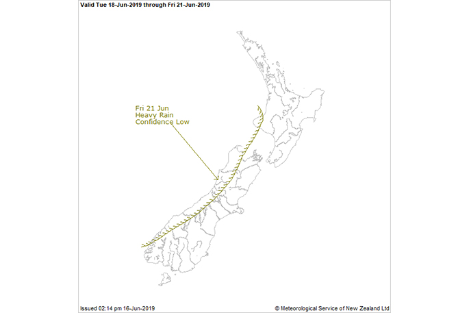
This trough and front should cross the country during Friday, bringing a period of rain to many areas, especially western and northern parts of both Islands where some heavy falls are possible.
There is still considerable uncertainty regarding the distribution of the heaviest rain. However, there is low confidence of rainfall amounts reaching warning criteria about western parts of the South Island from northern Fiordland to northwest Nelson and also about Mount Taranaki during Friday, as indicated on the chart.

0 comments
Leave a Comment
You must be logged in to make a comment.