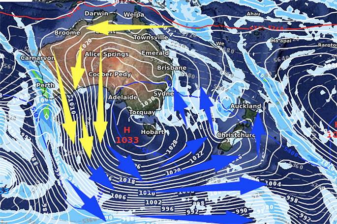
An enormous block of high pressure is building over Australia and will drive in colder air to NZ this weekend and linger for all of next week.
WeatherWatch.co.nz says the high is larger than Australia and this weekend it will be centred just south of the Great Australian Bight and just west of Tasmania.
This more southern placement means the anticyclonic wind flow around the high goes well down over the Southern Ocean and brushes the Antarctic region before coming up and over NZ.
 Next Friday, eight days from now.
This process will gradually become more noticeable in the days ahead. Friday is warmer than average for most of New Zealand ahead of this southerly change - in fact incredibly some places like Hawke's Bay and the upper North Island may reach 20 degrees, or at least the very late teens - well above normal.
"But on Saturday it spreads up the South Island and by Sunday and early next week the colder air spreads nationwide. Temperatures drop by both day and night and frosts return (after stopping for a time this weekend for many) into next week.
"New Zealand looks likely to be influenced by the cooler side of this enormous high pressure belt right across next week but winds may warm up a little at the end of next week.
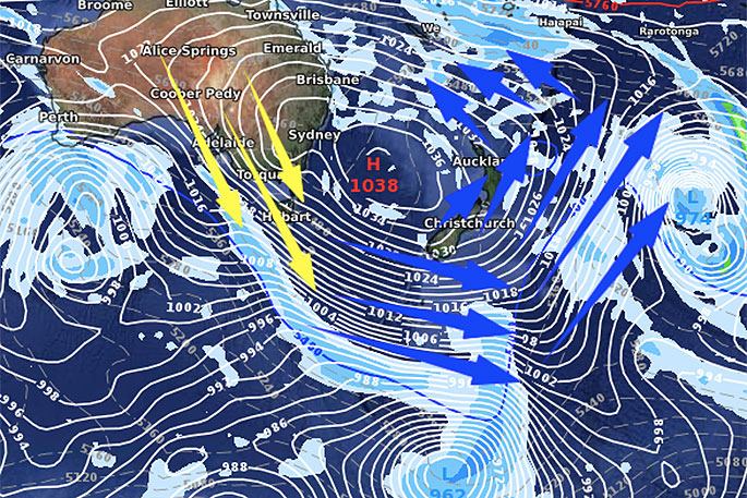
"Long range data suggests the centre of this big high will slowly track around northern NZ in 9 or 10 days time bringing more dry weather to northern NZ but perhaps a slightly warmer westerly flow to the South Island by then."

0 comments
Leave a Comment
You must be logged in to make a comment.