While the weather pattern is generally about to become much warmer than normal for July, we do have snow in the forecast next week, says WeatherWatch.co.nz
A low pressure system should track over the South Island on Monday and behind it comes a cold southerly that will see snow to low levels in the South Island - but only briefly.
"Totals may not be very big either, due to the fairly dry southerly coming in. Snow levels, at this very stage, are estimated to get down to about 400m, perhaps 300m.
"Totals at these levels does not look great this stage though. The highest risk for snow will be around Central Otago and Southland and through the lower Southern Alps."
Daytime highs take a hit early next week in the south too. Queenstown looks coldest with highs potentially as low as just 3 or 4 degrees and snow flurries possible in the town itself. But no other main centres look to be getting snow or to be getting this cold.
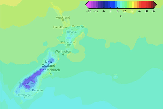
 Next Tuesday (note how the North Island and north east of the South Island are barely impacted)
"The cold also won't be going very far north.
"Christchurch does see a temperature drop next week but only back to near normal. Highs this weekend could be in the mid teens, like 16 or 17 degrees which is well above normal. By next Wednesday this cold air moves through Canterbury too and the high is 10 degrees - but will likely be sunny.
"At this stage the cold change won't even have enough oomph to bring snow to the Desert Road in the Central North Island. Warmer westerlies dominate northern NZ much more."
Long range data suggests the warmer westerly flow will quickly blow this southerly away next week.
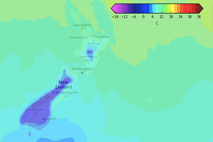
 Next Friday (July 19) - More warmth returns to the South Island.

0 comments
Leave a Comment
You must be logged in to make a comment.