A low from the sub-tropics is deepening quickly today as it moves into the upper North Island.
Following a calm weekend, easterly quarter winds are already picking up and will increase across the day and night, says WeatherWatch.co.nz
"As the low moves in the wind direction will change slightly which may see some areas become more sheltered while others get stronger gusts.
"Strongest winds kick in later today over Northland and Auckland with strong easterly quarter winds kicking in.
"Because the centre of the low is still developing and changing shape as it moves in across the upper North Island on Tuesday, that adds to the uncertainty about precise timing and areas affected so keep up to date with the HOURLY forecasts in your local 10 day forecast as it will show you upcoming average wind speeds and chance of rain.
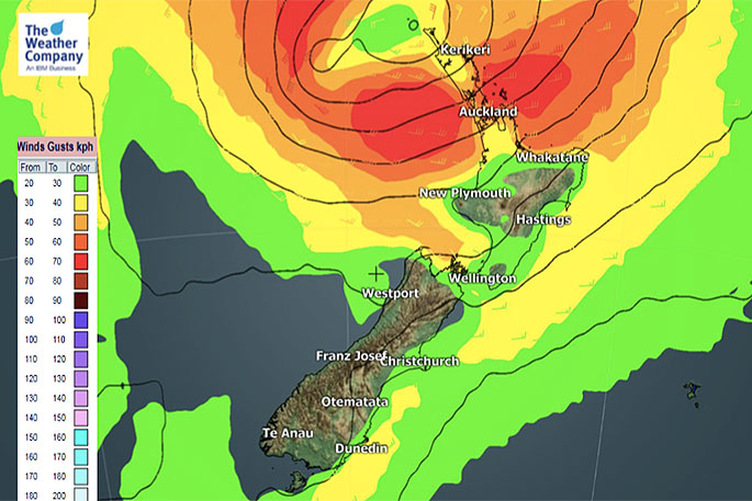
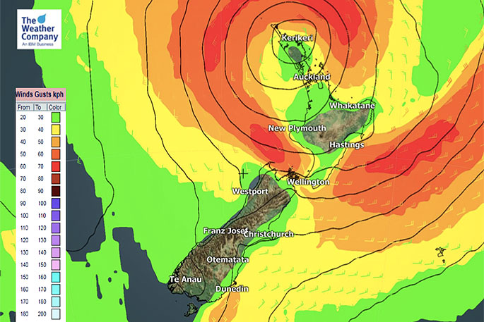 Noticeable gusty wind speed on Tuesday.
"Windy weather also moves further down the island tomorrow but as the centre moves in there will be calmer weather returning for others," says WeatherWatch.co.nz
"By Wednesday we get the tail end of the system with a blustery sou'wester for a time, mainly through the Auckland area and surrounds.
"Rainfall will be heaviest around the eastern side of the upper North Island over the next few days. Keep up to date with any tax funded warnings issued by MetService."
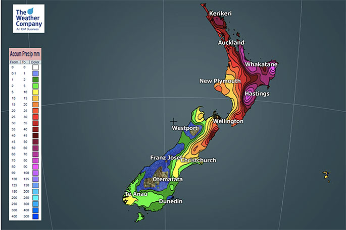 Three day total rainfall forecast until 7am Thursday.
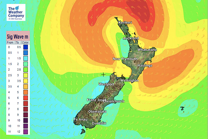 Noticeable significant wave height on Tuesday.

0 comments
Leave a Comment
You must be logged in to make a comment.