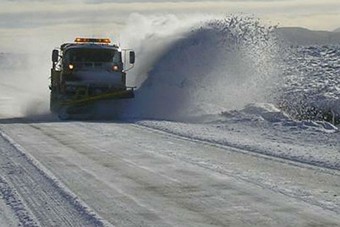
A cold change is making its way up the country and MetService is forecasting rain to turn to snow for some elevated roads.
However, most of the wet weather moves off the country on Friday leading to a relatively settled weekend albeit colder than normal.
Rain with snow lowering to around 700 metres is forecast for the Canterbury High Country and to 1000 metres over the central North Island tonight as the front makes its way northwards and Road Snowfall Warnings have been issued.
A snow warning is in place for the Desert Road for tomorrow.
'A few snow showers are expected to affect the road during Friday afternoon,” says the MetService.
'Between 1pm to 5pm Friday, expect 1 to 2cm of snow to settle on the road near the summit.”
The front moves through quickly and by Friday morning the front will lie to the north of the country with lingering cold southerly winds dropping temperatures for much of the country.
'A number of our weather stations in the South Island, as well as Wellington and Masterton will struggle to get into double digits for their maximum temperature tomorrow,” says MetService meteorologist Kyle Lee.
'Showers will linger in eastern areas of the country on Friday, but a ridge of high pressure starts to build over the South Island by the end of the day meaning settled weather will be in store for most of the weekend.”
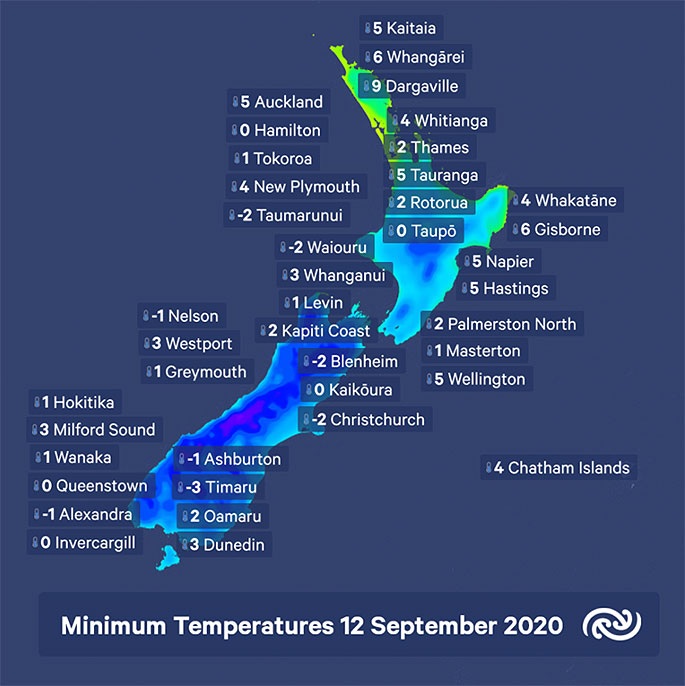
The combination of the lingering cold southerly winds and settled weather means most of our weather stations will show temperature readings well below their average minimum on Saturday morning.
'It's going to be cold start with most stations in the South Island around or below 0C, with the North Island temperatures also mostly below their average for this time of year.”
The weather is generally fine on Saturday, apart from remaining showers in the east of the North Island gradually clearing and a front expected to reach the far south by the end of the day.
On Sunday, another cold start is in store for the North Island as settled weather continues there.
Although much of the South Island is also expected to remain settled a front in the far south slowly makes its way northwards. The front is expected to bring rain in the far south and the west coast, as well as stronger westerly winds which should warm temperatures for the Island.
The start of the working week sees a return to a more significant weather as the front makes its way northwards with heavy rain and strong winds possible for parts of Aotearoa on Monday and Tuesday.

0 comments
Leave a Comment
You must be logged in to make a comment.