Coromandel's severe weather watch for heavy rain is now a warning.
The MetService issued a watch for the region on Saturday.
It has now issued a warning for the region.
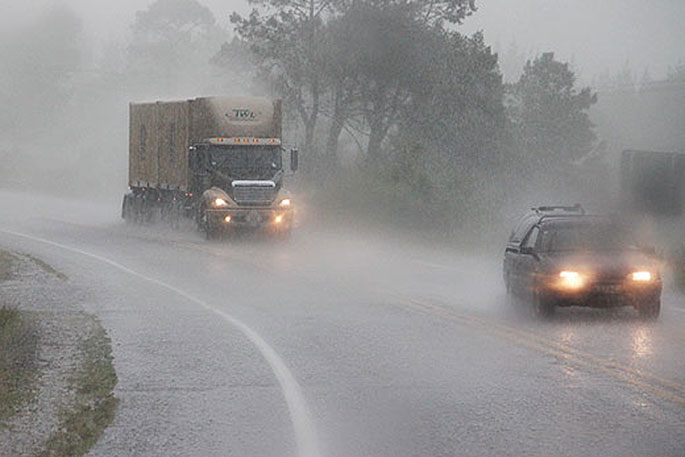
Heavy rain is forecast for the north of the North Island and northern parts of the South Island.
Gales are also predicted for Northland, Auckland and Coromandel Peninsula, says the MetService.
"A complex low pressure system affects northern and central New Zealand today and on Monday, bringing heavy rain to the north of the North Island, and northern parts of the South Island.
"The impact of this could be significant, especially for people engaged in outdoor activities such as camping. Localised flooding and damaging winds are possible in the areas covered by the watches and warnings.
"Heavy Rain Warning remains in force for northwest Nelson, and the Warning now includes Northland and Coromandel Peninsula. Heavy Rain Watches remain in force for northern Westland, Buller, the Richmond Range and northern Auckland.
"In addition, Strong Wind Watch for Northland has been upgraded to an Orange Warning. The Strong Wind Watch continues for Auckland, and now includes the Coromandel Peninsula.
"People are advised to keep up to date with the latest forecasts in case any Watches are upgraded to Warnings, or further areas are added."
Heavy Rain Warning
Heavy rain may cause streams and rivers to rise rapidly. Surface flooding and slips are also possible and driving conditions may be hazardous.
Area: Northland
Valid: 27 hours from 10am Sunday to 1pm Monday
Forecast: Periods of heavy rain. Expect 100 to 150mm of rain to accumulate, especially in the north and about the eastern hills. Peak rates of 15 to 25mm/h, and thunderstorms possible.
Changes: Upgraded to an Orange Warning.
Area: Coromandel Peninsula
Valid: 27 hours from 6am Monday to 9am Tuesday
Forecast: Periods of heavy rain. Expect 110 to 150 mm of rain to accumulate about the hills, and 70 to 100mm near the coast. Peak rates about 10 mm/h. Note, rain or showers should continue during Tuesday after the warning period.
Area: The ranges of Nelson west of Motueka
Valid: 10 hours from 10am to 8pm Sunday
Forecast: Expect a further 50 to 70mm of rain to accumulate on top of what has already fallen. Peak rates of 10 to 15mm/h.
Strong Wind Warning
Strong wind gusts could damage trees, powerlines and unsecured structures. Driving may be hazardous, especially for high-sided vehicles and motorcycles.
Area: Northland
Valid: 16 hours from 6pm Sunday to 10am Monday
Forecast: East to northeast gales are forecast to be severe at times, with gusts reaching 120km/h.
Changes: Upgraded to a Warning.Heavy Rain Watch
Area: Auckland from Albany northwards, including Great Barrier Island
Valid: 14 hours from 11pm Sunday to 1pm Monday
Forecast: Periods of heavy rain. Rainfall amounts may approach warning criteria.
Area: Buller and Westland from Otira northwards
Valid: 7 hours from 10am to 5pm Sunday
Forecast: Periods of heavy rain. Rainfall amounts may approach warning criteria, especially about the ranges.
Area: Richmond Range including Rai Valley
Valid: 7 hours from 10am to 5pm Sunday
Forecast: Periods of heavy rain. Rainfall amounts may approach warning criteria.Strong Wind Watch
Area: Coromandel Peninsula
Valid: 32 hours from 3am Monday to 11am Tuesday
Forecast: East to northeast winds may approach severe gale in exposed places at times.
Area: Auckland
Valid: 24 hours from 11pm Sunday to 11pm Monday
Forecast: Northeast winds may approach severe gale in exposed places at times.

0 comments
Leave a Comment
You must be logged in to make a comment.