
Rain is falling over the northern half of the North Island, and MetService is forecasting further periods of rain today.
The remainder of the country is also forecast to get some rain or showers this week as sub-tropical moisture pushes southwards, and then a cold front sweeps northwards.
A sub-tropical northerly wind flow spread warm and moist air over northern New Zealand on Monday and central New Zealand on Tuesday.
This will bring humid conditions and periods of rain or showers to northern and central New Zealand through until at least the middle of the week.
'At this stage eastern areas from Northland to East Cape should receive the largest amount of rain this week, which will be welcomed by many in these parched regions. However, there is also the potential for thunderstorms to be embedded in the bands of rain, and these may lead to localised heavy falls with downpours also possible,” says MetService Meteorologist Peter Little.
'Monday's rain broke a 37 day dry spell recorded at our Auckland Airport weather station, which is the second longest dry spell in the 60 years that site has been operating. The record dry spell is 38 days, which ended on 22 January 2020,” adds Little.
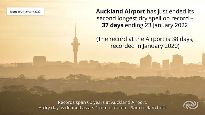 Image: MetService.
A cold front is forecast to move over the South Island on Wednesday and the North Island on Thursday.
This weak feature will bring a period of showers to most places as it passes northwards, along with cooler temperatures.
'The West Coast of the South Island has been unusually dry this month, and Wednesday's front doesn't look like it will deliver more than a few millimetres. Hokitika has received just 54 mm of rain so far in January, which is less than a quarter of their monthly average.”
A ridge of high pressure builds in behind the cold front, which sees fine and dry weather return to most places by the end of the week.

0 comments
Leave a Comment
You must be logged in to make a comment.