Twinkle twinkle little Earth, you floating ball of sea and dirt, lit up brightly in the night, aren't you just a pretty sight.
Twinkle little Earth of ours, I like you more than I like Mars.
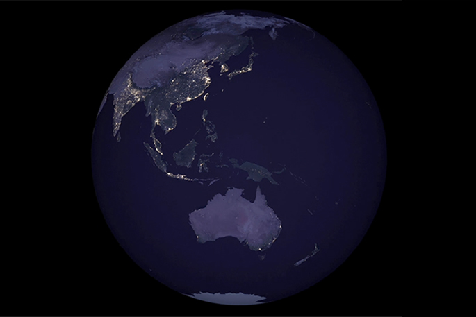
NASA says a new, high-resolution map the space agency released last week showing the Earth at night, as seen in 2016, provides the clearest composite view of human settlement across our planet to date.
As you'd expect, Europe, Asia and North America are lit up like Christmas trees in the space agency's map. South of the equator, but at the centre of the world, little ole New Zealand seems to be much in the dark – with Auckland our biggest, brightest, shining light (but don't tell them that).
'Satellite images of Earth at night — often referred to as 'night lights” — have been a gee-whiz curiosity for the public and a tool for fundamental research for nearly 25 years,” reads a post on the space agency's website.
'They have provided a broad, beautiful picture, showing how humans have shaped the planet and lit up the darkness. Produced every decade or so, such maps have spawned hundreds of pop-culture uses and dozens of economic, social science and environmental research projects.”
Images, which combined form the global composite map of night lights, were captured by the NASA-NOAA Suomi National Polar-orbiting Partnership satellite, which they launched in collaboration with the National Oceanic and Atmospheric Administration in 2011.
Suomi NPP observes nearly every location on Earth at roughly 1:30pm and 1:30am (local time) each day, observing the planet in vertical 3000-kilometer strips from pole to pole.
'VIIRS includes a special 'day-night band,” a low-light sensor that can distinguish night lights with six times better spatial resolution and 250 times better resolution of lighting levels (dynamic range) than previous night-observing satellites.
'And because Suomi NPP is a civilian science satellite, the data are freely available to scientists within minutes to hours of acquisition.”
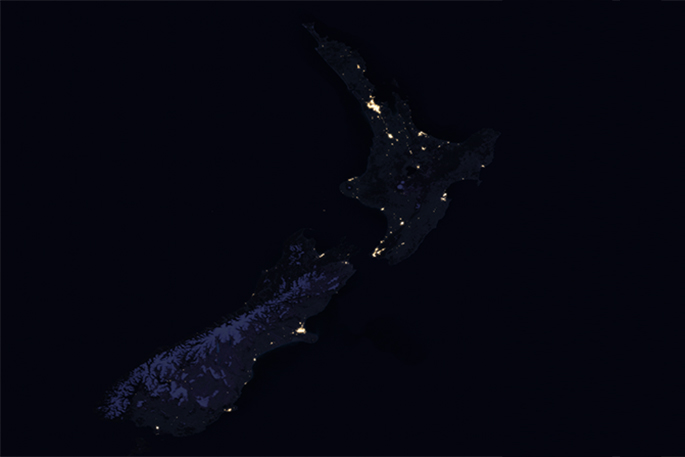 Night time in New Zealand. I wonder where the Goodnight Kiwi is?
But the project has not been without its own unique challenges.
According to NASA, the principal challenge in night-time satellite imaging is accounting for the phases of the moon, which constantly varies the amount of light shining on Earth, though in predictable ways.
'Likewise, seasonal vegetation, clouds, aerosols, snow and ice cover, and even faint atmospheric emissions (such as airglow and auroras) change the way light is observed in different parts of the world. The new maps were produced with data from all months of each year.
'The team wrote code that picked the clearest night views each month, ultimately combining moonlight-free and moonlight-corrected data.”
Armed with more accurate night-time environmental products, NASA is now automating the processing so users will be able to view night-time imagery within hours of acquisition – which has the potential to aid short-term weather forecasting and disaster response.
'Thanks to VIIRS, we can now monitor short-term changes caused by disturbances in power delivery, such as conflict, storms, earthquakes and brownouts. We can monitor cyclical changes driven by reoccurring human activities such as holiday lighting and seasonal migrations.
'We can also monitor gradual changes driven by urbanization, out-migration, economic changes, and electrification. The fact that we can track all these different aspects at the heart of what defines a city is simply mind-boggling.”
NASA also envisions many other potential uses by research, meteorological and civic groups, for example, daily night-time imagery could be used to help monitor unregulated or unreported fishing. It could also contribute to efforts to track sea ice movements and concentrations.
'Researchers in Puerto Rico intend to use the dataset to reduce light pollution and help protect tropical forests and coastal areas that support fragile ecosystems.
'And a team at the United Nations has already used night lights data to monitor the effects of war on electric power and the movement of displaced populations in war-torn Syria.”
To view Nasa's near real-time searchable satellite map of Earth, visit worldview.earthdata.nasa.gov
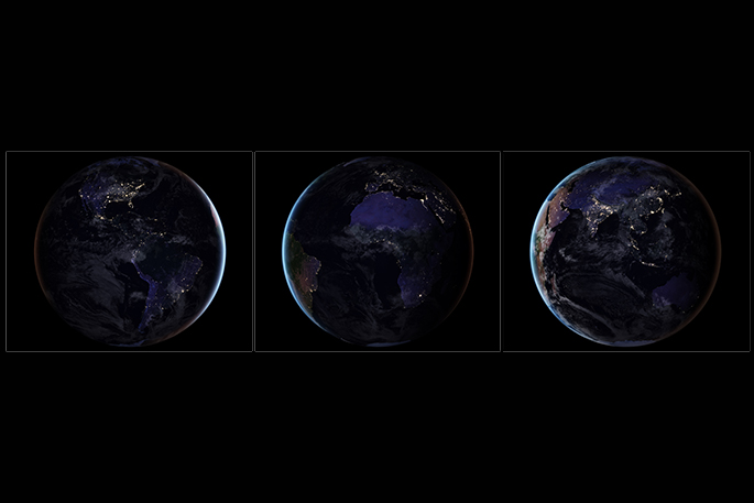 Three composite images which provide full-hemisphere views of Earth at night.

0 comments
Leave a Comment
You must be logged in to make a comment.