Kiwis are this morning waking to frosts, snow, and bone-chilling winds - but with it comes dry, fine and sunny conditions for most.
The National Institute of Water and Atmospheric Research (Niwa) says the country is in the middle of a “winter-like surge” with snow expected in the central North Island yesterday evening as polar air plunged temperatures to below zero.
MetService issued road snowfall warnings for four mountain passes in the South Island yesterday, with up to 5cm of snow expected to settle overnight last night.
Meanwhile, temperatures in Auckland were forecast to drop to 6C overnight and to fall to 4C tonight.
Throughout today, the daily high could hit 17C with fine conditions and cool southerly winds.
Frosts are also likely Friday morning. MetService credits the cooler temperatures to a string of cold fronts sweeping the country with brisk, southerly winds.
MetService meteorologist John Law says it's possible the North Island could get frosts, and explains that clear night skies and cold winds created “perfect conditions” for cooler-than-average temperatures.
Looking ahead to the weekend, the city could dip to 5C on Saturday night with a 7C overnight low forecast for Sunday.
Saturday’s high was tipped at 15C while Sunday should reach 16C. Both days should see sunny skies and fresh southerlies.
Speaking of snow about the North Island, Law says: “If you’re in Hawke’s Bay tomorrow and you look out at the hills to the west of you, you may see a dusting of snow.”
It comes after Taumarunui started Wednesday at -4C. Taupō began the day at -2C. Further south, Christchurch woke to -3C, Timaru started at -2C and Queenstown saw -1C.
Niwa says this is a “fast start to the snowy season” and says Friday will be “a very cold day for the time of year”.
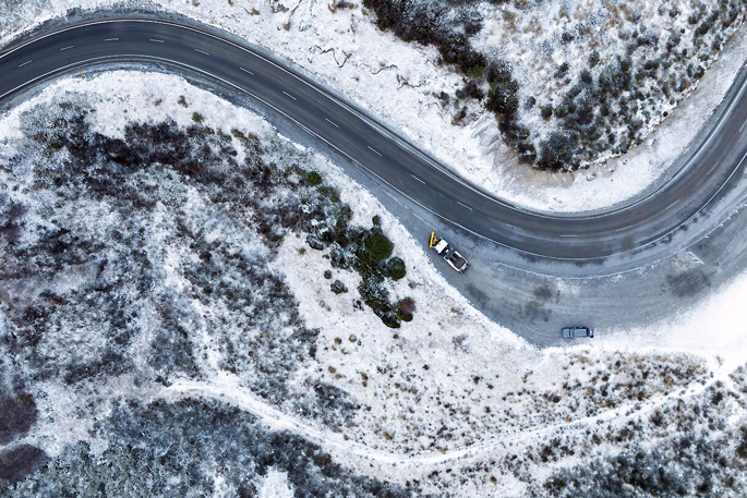
 Snow in Porters Pass today. Photo / George Heard.
Some of the winds likely to buffet the country overnight tonight could reach 80km/h in exposed places around Westland, in the South Island. Gales are also possible around Wellington and Marlborough tomorrow morning.
The earliest road snowfall warning came into place at 3pm Wednesday, for the Crown Range Rd. It should end at 6pm the same day.
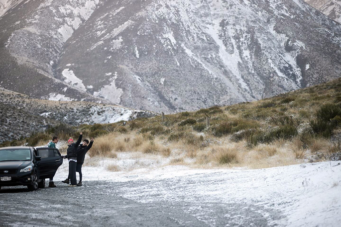
Lewis Pass, State Highway 7, Arthur’s Pass, SH73, and Porters Pass were under road snowfall warnings from 7pm Wednesday at the earliest to 3am Thursday at the latest.
Flurries on the Crown Range Rd were recorded at 4pm Wednesday - promoting warning from MetService to motorists to “drive safe and take care on the wet roads and poor visibility”.
MetService meteorologist Mmathapelo Makgabutlane says this May is a stark contrast with last year.
“Many may recall the tropical-feeling temperatures of May 2023, where places like Auckland and Hamilton experienced record-breaking warm nights. However, this year, expect an overnight drop to mid-single digits in Auckland City and early morning temperatures hovering near freezing in Hamilton,” says Makgabutlane.

0 comments
Leave a Comment
You must be logged in to make a comment.