Parts of New Zealand are set to experience thunder and lightning over the coming days, with the highest risk being the central and upper North Island on Thursday and early Friday.
New Plymouth and Hamilton may get an unwelcome wakeup call on Thursday morning, as an active front with thunderstorms rolls across the North Island bringing localised heavy rain, hail and strong wind gusts of 100km/h.
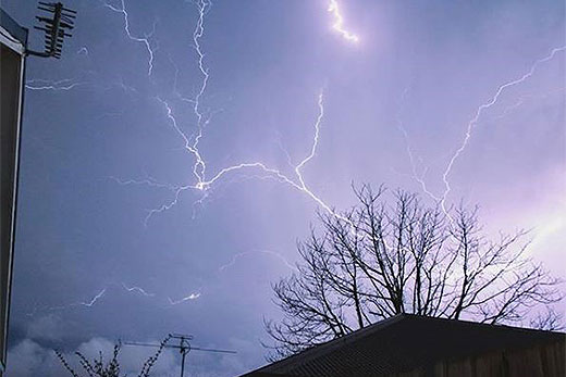
Image from Renee Elley via renee.elley on Instagram
The same front looks set to move across Auckland around the morning commute, possibly leading to some adverse driving conditions.
Unstable conditions continue over the North Island and upper South Island through to Friday morning, with a further high risk of thunderstorms from Thursday evening bringing rain, hail and even stronger wind gusts reaching 110km/hr or possibly more in places.
'The wind gusts in particular may prove troublesome and potentially damaging,” says MetService meteorologist Tom Adams.
"With saturated ground conditions also increasing the chances of trees blowing over and the possibility of damage to power lines”.
In addition to the thunderstorms in the North Island, there is a moderate chance of thunder in the South Island for the West Coast and inland Canterbury and North Otago.
Snow could also lower to 1000 metres over the central North Island overnight Thursday, possibly affecting the Desert Road, says Tom.
Although Friday morning will see a continuation of the strong winds and localised squally thunderstorms in the upper North Island, conditions should gradually ease later in the day.
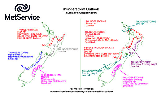
MetService thunderstorm outlook charts, available on http://info.metraweather.com/e/60812/warnings-thunderstorm-outlook/bhpknt/427423540

0 comments
Leave a Comment
You must be logged in to make a comment.