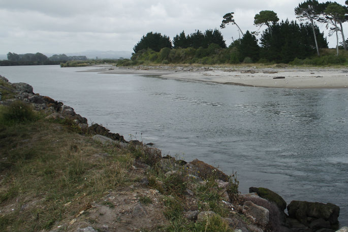
World Rivers Day on Today marks the opening of public access to the latest science information about the state of Bay of Plenty waterways.
The information on the Land Air Water Aotearoa website brings together environmental monitoring data from 16 regional and unitary councils across the country, and independently confirms it's credible through independent verification by the Cawthron Institute.
'It means everyone can access some of the country's best science information and see what it's saying about the state of our land, air and water over time,” said Bay of Plenty Regional Council Science Manager Rob Donald.
The LAWA website is regularly updated throughout the year, but annual trends from lake, river and aquatic insect monitoring have been updated with 2016 data from today. A new land-cover section, that helps people explore the connection between land use and water quality, has also gone live for the first time.
The new land-cover module includes descriptions and extent of various types of vegetation, water bodies, built environments, and bare natural surfaces (such as gravel and rock) throughout the country. It also shows how these have changed over time.
The type and location of vegetation cover can influence land stability, says Rob. The amount of sediment and contaminants reaching our waterways and the movement of water through the landscape.
'So it's a useful part of the picture when people are trying to understand what impacts water quality, and what might need to be done to improve it,” says Robb.
Bay of Plenty Regional Council and Local Government New Zealand Regional Sector Chairman Doug Leeder says it is increasingly important the public has up-to-date information on the quality of their waterways.
'Having easy access to reliable information will create a greater understanding on the state of our waterways, help people make good choices about how they use them, and help support the changes that they want to see for their lakes and rivers,” says Doug.
Freshwater Group Manager at the Cawthron Institute Dr Roger Young says LAWA is a world first initiative in making a wide range of environmental data for a whole country available to the public in one place.
'LAWA is all about open, transparent access to data that everyone can trust. As independent validators, our role is to check that the data is collected, analysed and reported in the right way and can be trusted,” says Roger.
A new LAWA live on World Rivers Day is ‘land cover', which describes the types of vegetation and features that cover the land's surface, like forests, shrublands, grasslands, crops, urban areas, or roads. The type and location of vegetation cover can influence land stability, the amount of sediment and contaminants reaching waterways and the movement of water through the landscape.
'By measuring land cover, we can start to understand the physical make-up of our landscapes and how they are changing,” says LAWA Chair and Otago Regional Councillor Stephen Woodhead
'The biggest factor impacting land change is caused by people and the health of waterways is directly related to what happens on the land around them,” says Stephen.
- LAWA was launched in 2014 to provide New Zealanders with more accessible information about natural resources. It is a collaboration between New Zealand's 16 regional and unitary councils, the Cawthron Institute, and the Ministry for the Environment, and has been supported by the Tindall Foundation.
- Work on other environmental indicators for LAWA is ongoing and next year the website will show information on groundwater quality. The ‘Can I swim here?' topic will also be enhanced to provide more information on suitable places for swimming.

0 comments
Leave a Comment
You must be logged in to make a comment.