Heavy rain, strong winds and snow is being forecast for the central North Island this week.
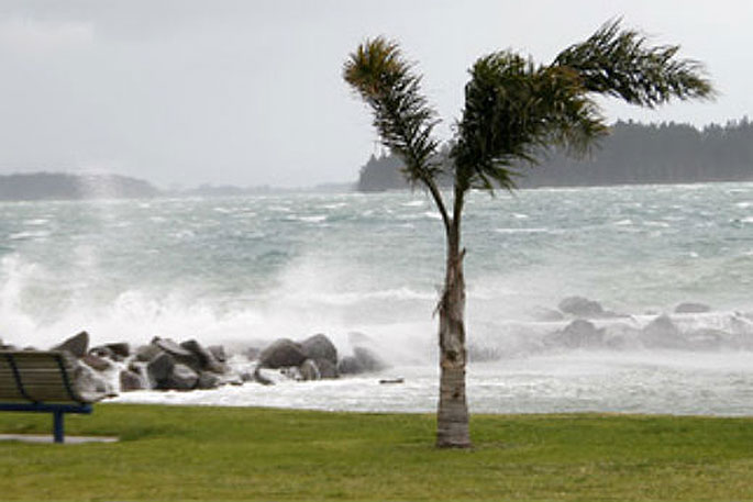
A strong wind watch is in force for the Bay of Plenty as a low over the Tasman Sea is forecast to deepen as it slowly approaches the country during today.
The MetService says this should move southeastwards across the central North Island on Wednesday before moving away to the southeast Wednesday night.
"A front associated with the low crosses the upper North Island Wednesday morning and afternoon, bringing a brief burst of heavy rain with localised downpours, squally thunderstorms and strong northerly winds to upper parts of the North Island.
"In addition, strong west to southwest winds are expected to affect the upper North Island overnight Wednesday.
"The low also delivers a period of rain and strong southerly winds to central New Zealand for a time on Wednesday, with heavy snow possible down to 300 metres for eastern Marlborough.
"People are advised to keep up to date with the latest forecasts in case parts of the Watch are upgraded to a Warning, or other areas are added."
HEAVY RAIN WATCH
Area: Northland
Valid: 7 hours from 6am to 1pm Wednesday
Forecast: Rain accumulations may approach short duration Warning amounts in some places during this time. Localised downpours and squally thunderstorms are possible.
Area: Auckland including Great Barrier Island, Coromandel Peninsula, and northern and eastern parts of Waikato
Valid: 7 hours from 9am to 4pm Wednesday
Forecast: Rain accumulations may approach short duration Warning amounts in some places during this time. Localised downpours and squally thunderstorms are possible.
Area: Bay Of Plenty including Rotorua
Valid: 8 hours from 11am to 7pm Wednesday
Forecast: Rain accumulations may approach Warning amounts in some places during this time. Localised downpours and squally thunderstorms are possible.
Area: Northwest Nelson
Valid: 14 hours from 4am to 6pm Wednesday
Forecast: Rainfall accumulations may approach Warning amounts.
HEAVY SNOW WATCH
Area: Eastern Marlborough
Valid: 12 hours from 8am to 8pm Wednesday
Forecast: Rain may turn to snow down to 300 metres and snow accumulations may approach Warning amounts above 300 metres during this time.
In addition, rainfall accumulations may approach Warning amounts below the snow level during this time.
STRONG WIND WATCH
Area: Northland, Auckland including Great Barrier Island, Coromandel Peninsula and northern Waikato
Valid: 24 hours from 6am Wednesday to 6am Thursday
Forecast: Two periods of strong winds are expected during this time.
Between 6am and 3pm Wednesday, northerly winds may approach severe gale in exposed places.
Between 9pm Wednesday and 6am Thursday, west to southwesterly winds may approach severe gale in exposed places.
Area: Bay Of Plenty including Rotorua
Valid: 8 hours from 11am to 7pm Wednesday
Forecast: Northerly winds may approach severe gale in exposed places during this time.
Area: Wellington, Kapiti, Wairarapa and Coastal Marlborough including the Sounds
Valid: 8 hours from 5pm Wednesday to 1am Thursday
Forecast: Southerly winds may approach severe gale in exposed places.

0 comments
Leave a Comment
You must be logged in to make a comment.