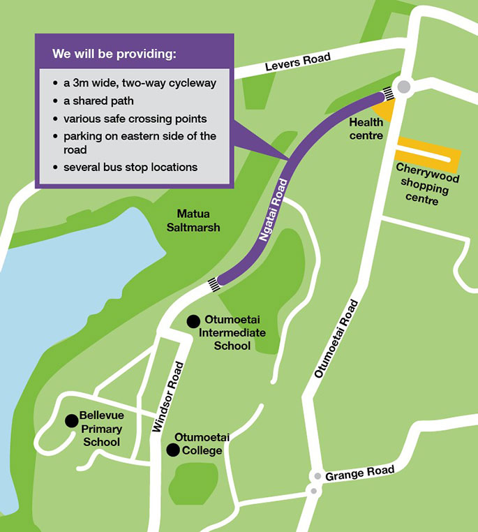
A two-way cycleway, shared paths, various safe crossing points and several bus stop locations will be implemented between the Otumoetai Road roundabout and the Matua saltmarsh.
The new layout is part of Tauranga City Council's ambitions to create better urban connections, works on a new road layout for Ngatai Road in Otumoetai have been confirmed for the second half of January 2020.
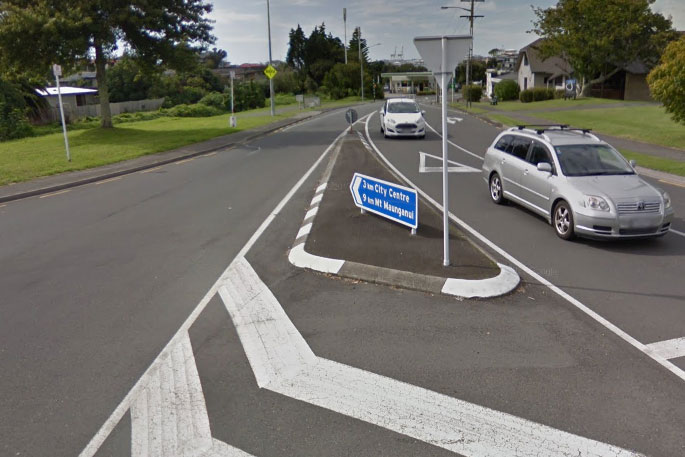
"Parking on the eastern, Carlton Reserve side of the road will be retained," says a Tauranga City Council spokesperson.
"The goal is to make this road a safer, more accessible and attractive transport route for all road users while enabling people to choose between various ways to get around the city, instead of relying mainly on cars."
Why Ngatai Road?
Ngatai Road is a key connection between Bellevue, Matua and Otumoetai, Pillans Point and the central city but is also a road where concerns have been raised about speed and safety, says Tauranga City Council.
Recent approval of funding from Waka Kotahi NZ Transport Agency means the next steps can be taken.
Following earlier consultation and engagement with the local community and schools, construction is now set to commence in the second half of January 2020 and expected to take approximately six months, dependent on the weather.
'With three schools in the area, we are especially mindful of the safety of children going to and from school," says network safety and sustainability manager Martin Parkes.
"This project provides a great opportunity to encourage more students to bike or walk to school and reduce congestion at the school gates.
"But the benefits will be for a broader group than that as this road is part of an important route for people travelling to and from the city centre."
'We are in close contact with council about this project and are excited to see the work progressing. Keeping our kids safe is our main priority and we feel that the current plans will contribute to exactly that," says Otumoetai College principal Henk Popping.
More about the plans
The project is focused on the section of Ngatai Road between the Otumoetai Road roundabout and the Matua Saltmarsh. The plans include:
- A new on-road, physically separated, 3-metre wide two-way cycleway along the western, Saltmarsh side of the road.
- An upgraded combined pedestrian/cycle crossing opposite the Matua Saltmarsh.
- A new combined pedestrian/cycle crossing close to the Otumoetai Road/Ngatai Road roundabout.
- A new shared pedestrian/cycle path between the Matua Saltmarsh and Otumoetai Intermediate School, on the eastern side.
- New shared pedestrian/cycle paths close to the Otumoetai Road/Ngatai Road roundabout.
- Three upgraded bus stops on either side of the road.
The two-way cycleway and shared pedestrian/cycle crossings are new to Tauranga.
Two-way cycleways are already common in other cities like Christchurch and Auckland. This type of cycleway minimises impact on parking while keeping a high level of safety for people on bikes.
The combined pedestrian/cycle crossings are a first for Tauranga's residents as well. To make people aware of the changes and how to use the new road layout an educational campaign will be rolled out.
Developing a connected transport network
After the completion of the Matarawa Pā bridge over State Highway 36 and the upgrade of the Kopurererua Valley walking and cycling track, this project is the next step in delivering a connected city-wide cycle network.
The intention is to get more people riding bikes, more often, by providing safe, linked cycling facilities across Tauranga.
This aligns with Tauranga City Council's wider plans to create better urban connections by providing safer, more accessible and attractive transport routes – not only for people on bikes but for all road users.
'To help manage traffic congestion as the city grows, we need to make it easier for more people to travel by bus, on bicycles, on foot and on mobility devices," says infastructure general manager Nic Johansson.
"This project is one piece of the puzzle in minimising future congestion issues and supporting liveable, healthy and sustainable communities.”
Council encourages people who are interested in this project to sign up to a newsletter that will provide regular updates.
Subscribe via: www.tauranga.govt.nz/ngatai. This web page also includes more information and a copy of the plans.

2 comments
Traffic
Posted on 11-12-2019 14:58 | By Kancho
I think safety was the reason for Greerton alterations. A big success as one can walk through Greerton quicker and than driving. And getting in and out of the super market and shops is safer because it go elsewhere now. Mind you Pyes Pa road remains a scary place to shop too with the speed . Wonder what happened to the petition to lower the speed on Pyes Pa road ? I was told probably two years ago the speed was under review, seems it still is ??
Accidents . . .
Posted on 11-12-2019 22:49 | By Yadick
What are the accident stats for this stretch of road? Is this going to be another Greerton screw-up? I'm all for keeping the kids safe but that also comes down to pro-active parenting. Give us the stats before spending OUR money. Correct me if I'm wrong but to me this appears to be a great bit of road and the only requirement is the same as around any school - a bit of good pro-active policing.
Leave a Comment
You must be logged in to make a comment.