This September marks 25 years since the start of the 1995-1996 Mt Ruapehu volcanic eruptions.
Sitting at 2797m, Mt Ruapehu is the highest mountain in the North Island and has been the source of eruptions for over 200,000 years, creating a significant impact on this country's landscape, mythology and history.
Ruapehu means ‘pit of noise' or ‘exploding pit' in te reo Māori, a fitting description given that the mountain is one of the more active volcanoes in New Zealand.
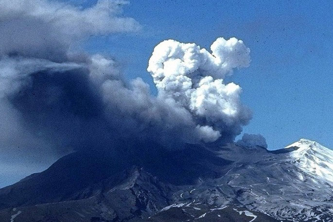
The most notable of the mid-ninety's eruptions was on September 23, 1995. With drama and enthusiasm, the volcano shot ballistics (flying rocks) into the sky and plumes of hot ash and steam.
"This eruption sent lahars – a raging mix of water, mud, ice and debris – surging through the ski fields and into the Whangaehu River. Fortunately, there were no injuries or deaths," says a statement on the GeoNet website.
"What people may not remember are the smaller eruptions earlier in that year, and even an eruption the week prior to September 23, also causing a lahar. Weather conditions at the time were poor, and visibility low, so the events didn't get the same level of media and public interest as the eruption on September 23.
"Later that year, and in 1996, further eruptions caused ashfall to settle on homes, cars, and buildings from later eruptions that year.
"Crops were damaged, and water supplies, roads and power were all disrupted. Some animals died as a result of ash ingestion and fish in local rivers were affected by lahars.
"The eruptions also forced flight cancellations, airport closures, and rerouted flights."
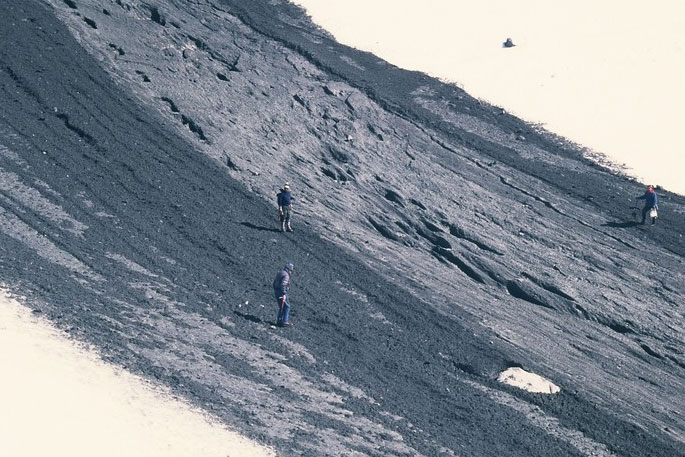 Ruapehu Whakapapaiti lahar deposit.
These eruptions removed the crater lake and modified the crater rim and outlet area.
The new crater lake, which started to fill in 2003, filled to a level about nine metres above the outlet and was held in by a dam of volcanic debris.
This dam failed in March 2007 creating a dam break lahar in the Whangaehu Valley and river, says GeoNet.
A tragic history
In recent history, Mt Ruapehu's crater lake outlet has collapsed every 50 years or so, sending a dam-break lahar down the mountain.
The largest was in 1863, but the most devastating lahar was on Christmas Eve 1953. That lahar surged into the Whangaehu River weakening the Whangaehu River rail bridge, only minutes before the Wellington–Auckland night express train was due to cross.
The rail bridge buckled under the train, and the front carriages plunged into the flooded river, killing 151 of the 285 people on board.
To this day, the Tangiwai rail disaster remains one of New Zealand's worst disasters, says GeoNet.
"Over the years, lessons from eruption impacts and dam breaks have led to improvements on the mountain and in the wider area.
"Bridges have been raised and built strong enough to withstand the force of a lahar. In anticipation of future lahar, monitoring equipment was installed to give advance warning to road, rail, and other infrastructure. A warning system for eruptions is also in place on the ski fields."
Keeping a watchful eye
"The power and volatility of this country's active volcanoes has led to intense monitoring of our volcanoes over the years funded by EQC, through GeoNet.
"For Mt Ruapehu this monitoring is done in partnership with the Department of Conservation.
"Monitoring Mt Ruapehu we have three web cameras, 10 seismographs and six microphones which detect volcanic explosions.
"In addition, nine continuous GPS stations around the volcano record ground deformation, and volcanologists sample water and gas from the crater lake (Te Wai ā-moe) and airborne gas monthly."
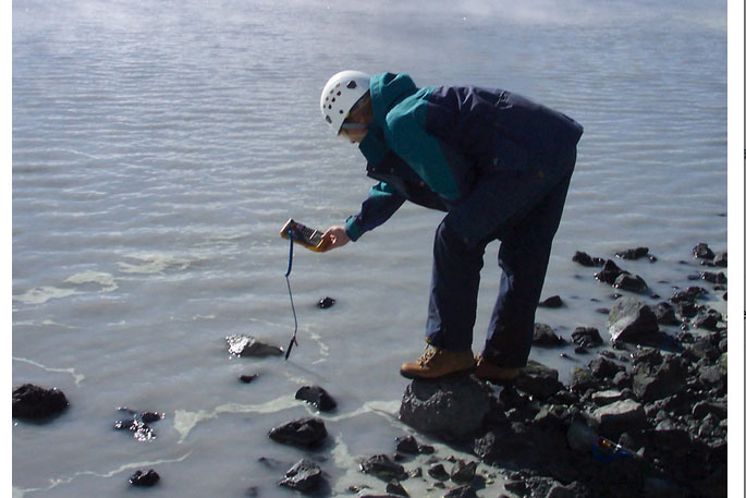 Measuring the lake temperature.
NEMA's (National Emergency Management Agency) website has great information on what to do before, during and after a volcanic eruption.
At GNS Science, you can find more about preparing for, and cleaning up volcanic ash.

0 comments
Leave a Comment
You must be logged in to make a comment.