
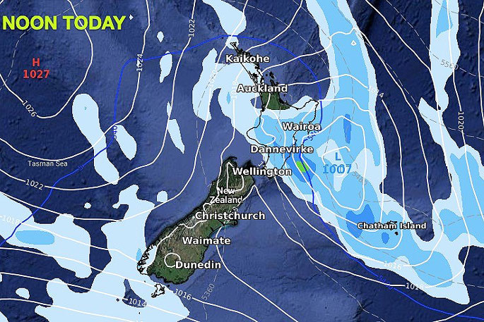
Low pressure off the North Island's east coast will today drive in heavy rain to Wairarapa and potentially into Hawke's Bay too.
The low will linger just offshore for the next 12 to 18 hours before pulling away from NZ and moving out to sea.
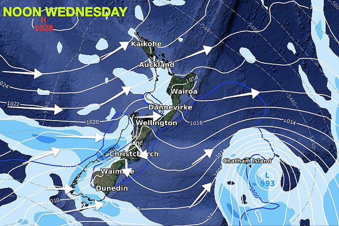
As the low moves away, back come the westerlies, says WeatherWatch.co.nz
"Wednesday and Thursday see westerly winds in most places, pushing showers back into the western side of NZ.
"However, by Thursday a cold front will move up NZ and despite it being fairly weak it will bring a temperature drop and showers into eastern areas and Wellington/the lower North Island."
WeatherWatch.co.nz says places like Christchurch and Wellington will drop about 4 or 5 degrees on Thursday compared to Wednesday.
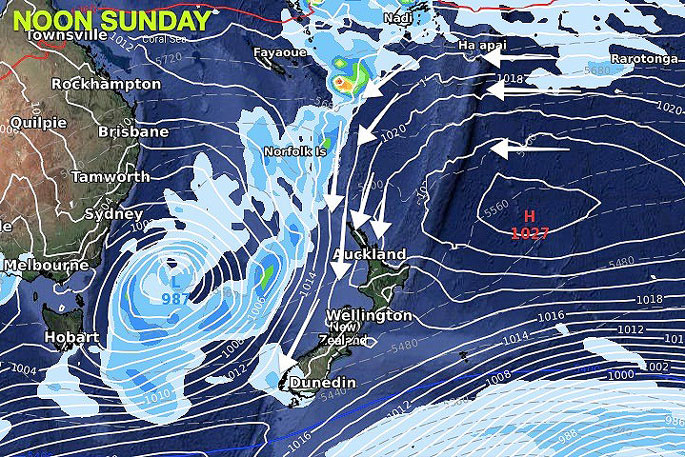
"By Friday, high pressure will be parked over the North Island and that will start to encourage sub-tropical winds into Fiordland and Southland (being our western most regions they can often be impacted by an incoming northerly before northern NZ).
"Over Saturday and Sunday increasingly sub-tropical and mild northerly winds will spread over both main islands.
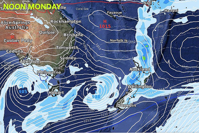
"Early next week a likely wet nationwide nor'easter around Monday, followed by a week of westerly driven showers."
 Images: WeatherWatch.co.nz

0 comments
Leave a Comment
You must be logged in to make a comment.