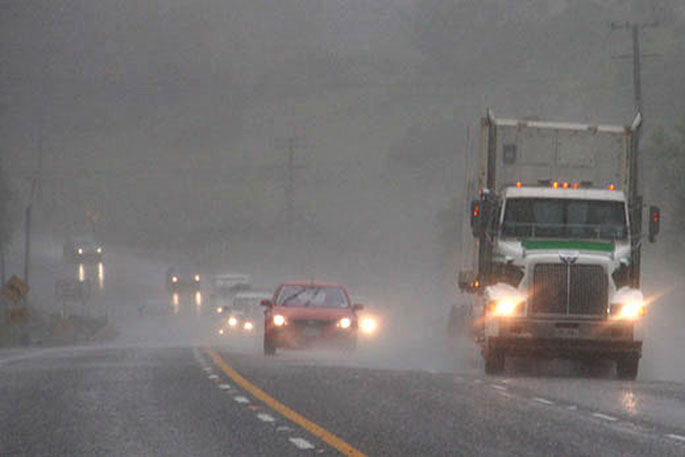
The MetService is forecasting 130 to 180mm of rain to fall in the Bay of Plenty in a 20 hour period from 3pm Tuesday.
A severe weather warning for heavy rain has been issued for the region as Tropical Cyclone Ruby tracks towards NZ.
"A series of lows are expected to bring strong to gale northeast to easterly winds across the North Island and upper South Island during Tuesday and Wednesday," says a spokesperson for the weather organisation.
"Very warm and humid conditions are likely, with the heaviest rain expected over the central and upper North Island, and over the west of Nelson."
A severe weather watch is also in force for the Coromandel area, with heavy rain forecast from Tuesday afternoon through to Wednesday morning.
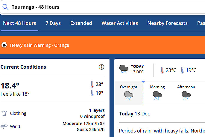 Image: MetService.
HEAVY RAIN WARNING - ORANGE
Heavy rain may cause streams and rivers to rise rapidly. Surface flooding and slips are also possible and driving conditions may be hazardous.
Area: Bay of Plenty
Valid: 20 hours from 3pm Tuesday to 11am Wednesday
Forecast: Periods of heavy rain. Expect 130 to 180mm of rain inland, and 70 to 100mm about the coast. Peak intensities of 15 to 25mm/hr Wednesday morning.
Change note: The Yellow Warning for today is now lifted. This Orange Warning is for the upcoming event on Tuesday and Wednesday.
Area: Mount Taranaki
Valid: 18 hours from 9pm Monday to 3pm Tuesday
Forecast: Periods of heavy rain. Expect 100 to 150mm of rain. Peak intensities of 15 to 25mm/hr.
Area: Nelson, about and west of Motueka
Valid: 26 hours from 8am Tuesday to 10am Wednesday
Forecast: Periods of heavy rain. Expect 120 to 150mm of rain. Peak intensities of 15 to 25mm/hr Tuesday morning and afternoon, and again Wednesday morning.
HEAVY RAIN WATCH
Area: The north and east of Northland
Valid: 9 hours from 4pm Tuesday to 1am Wednesday
Forecast: A period of heavy rain. Rainfalll accumulations may approach warning amounts.
Area: Auckland from the Whangaparaoa Peninsula northwards, including Great Barrier Island
Valid: 9 hours from 8pm Tuesday to 5am Wednesday
Forecast: A period of heavy rain. Rainfall accumulations may approach warning criteria.
Area: Coromandel Peninsula
Valid: 13 hours from 8pm Tuesday to 9am Wednesday
Forecast: A period of heavy rain. Rainfall accumulations may approach warning amounts.
Area: Eastern Waikato and Taupo
Valid: 12 hours from 9pm Tuesday to 9am Wednesday
Forecast: A period of heavy rain, mostly on Wednesday morning.
Rainfall accumulations may approach warning amounts.
Area: Gisborne north of Tokomaru Bay
Valid: 15 hours from 11pm Tuesday to 2pm Wednesday
Forecast: Periods of heavy rain. Rainfall accumulations may approach warning amounts.
Area: From North Taranaki (except the Mountain) to Waitomo, and across to inland Whanganui and Taihape
Valid: 18 hours from 9pm Monday to 3pm Tuesday
Forecast: Periods of heavy rain. Rainfall accumulations may approach warning criteria.

0 comments
Leave a Comment
You must be logged in to make a comment.