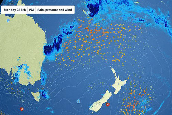
MetService is forecasting a large region of high pressure to bring mostly settled, albeit cooler, conditions around the country for the first week of meteorological autumn.
"Looking north of our shores, we can see a tropical depression currently bringing persistent rain between Vanuatu and New Caledonia," says MetService meteorologist Lewis Ferris.
"However, the weather around Aotearoa is relatively benign this week thanks to a stubborn high-pressure system that is keeping away any widespread, significant weather systems."
With Monday being the last day of meteorological summer, it's easy to see that it has been a standout for persistent heat in the northern regions, says Lewis.
Whangārei, Auckland and Hamilton Airports have all broken their summer (December-February) records for number of ‘hot days'.
A ‘hot day' being defined as a daily maximum temperature at or above 25°C.
Christchurch Airport on the other hand has seen just below average amounts of hot days (19) and has recorded its third wettest summer (data back to 1943).
Around 314mm of rain made up of the wettest Feburary and third wettest December on record at that site.
"It's not only the air temperatures that have been breaking records – the coastal waters around New Zealand have been unusually warm this summer.
"MetOcean Solutions ocean models and satellite data show a marine heatwave off the North Island's west coast in mid-December blew all records with temperatures reaching 4 degrees above average.
"While a marine heatwave off Wairarapa, which lasted more than 80 days over the summer, brought heating of 1-2 degrees above average that extended tens of kilometres offshore, and down to more than 75 metre depth.
"The longest marine heatwave this summer has been unfolding in the Bay of Plenty; since early November, sea surface temperatures have been 1-2 degrees warmer than average.
"Over the coming week marine heatwaves conditions are expected to continue in the Hauraki Gulf, Cape Reinga, the Bay of Plenty and Raglan."

Daily updated Moana Project marine heatwave forecasts are available at https://www.moanaproject.org/marine-heatwave-forecast


0 comments
Leave a Comment
You must be logged in to make a comment.