Some more wild weather is on the way for the Bay of Plenty tomorrow.
Heavy rain is being forecast for the region as a subtropical low develops to the northeast of the North Island today, then deepens and moves southwards on Wednesday, then stays slow-moving to the east of the North Island during Thursday and Friday, says the MetService.
"This system directs a moist northeast flow across the North Island today and Wednesday, then south to southeasterly winds for much of the Island during Thursday and Friday.
"Heavy rain warnings are now in force for Bay of Plenty, Gisborne and Hawke's Bay,and a heavy rain watch for Taupo and Tasman west of Motueka.
"There is some uncertainty where the heaviest rain will fall over the northeast of the North Island, however downpours and significant flooding are possible for Bay of Plenty and Gisborne.
"This has the potential to be an extreme event and people are urged to keep up to date with advice from MetService in case Bay of Plenty and Gisborne need to be escalated to Red Warnings."
Meanwhile, people are still refelcting on the wild weather experience yesterday.
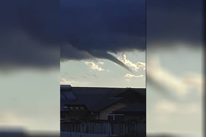
"Well we did end up getting some rotation for the upper North Island yesterday," says WeatherWatch.co.nz, "the really heavy rain and more dramatic lightning occurred in the morning especially for the likes of Auckland then later in the afternoon more storms formed which showed more structure to them and a few funnels developed."
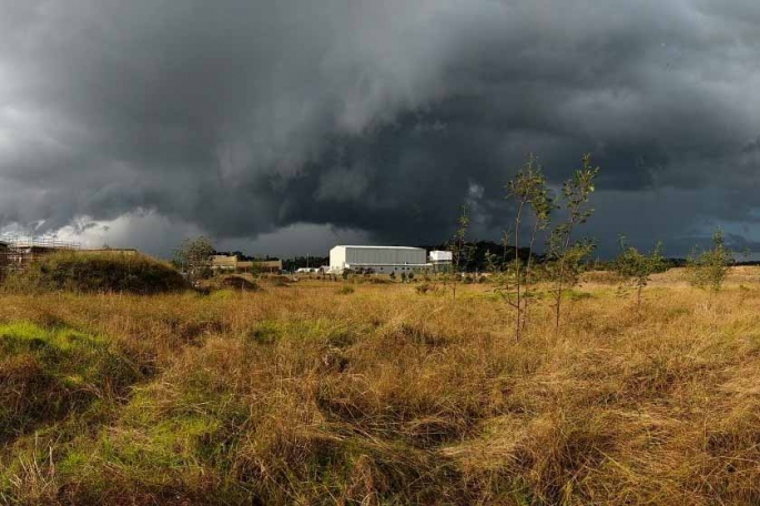 "furious scud action" with this cloud which may indicate some rotation at North Shore. Photo: Graeme Williams
There was some gnarly looking clouds moving through Auckland on the North Shore some time between 4.30pm and 5pm.
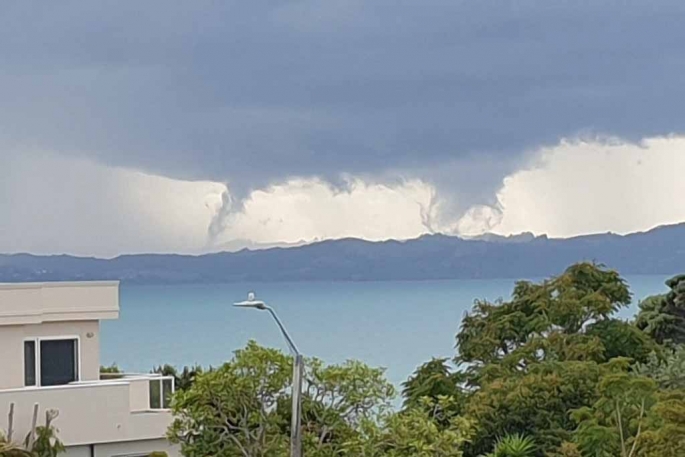 Whangaparaoa looking across to Mahurangi West at 5.05pm Photo: JP Mower.
JP noted at one point he saw 3 funnels at the same time, "Never seen anything like it" he said.
The photo may be teetering on the edge of funnel action but at this stage looks to be more like some active looking scud.
More unstable showers today?
Yes there is a chance of more unstable showers today for the North Island, meaning thunderstorms in other words, says WeatherWatch.co.nz
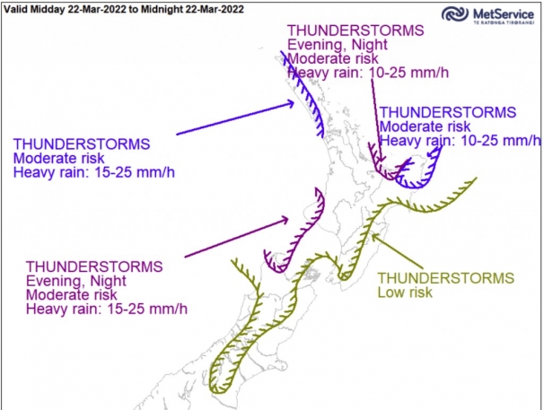
Heavy rain Northeastern North Island overnight
Some heavy rain looks to move into East Cape, Gisborne and perhaps Hawke's Bay overnight and hangs around tomorrow at times then really builds later tomorrow and through to Thursday morning.
Keep up to date with our latest rain maps here and the latest watches and warnings from Metservice here.
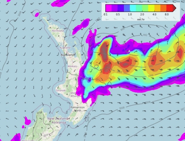 MSLP / Rain map - Thursday 24th March 4.00am 2022. Photo: WeatherWatch.co.nz


0 comments
Leave a Comment
You must be logged in to make a comment.