UPDATED 10.18AM: A severe weather warning issued for the Bay of Plenty and Coromandel has now been lifted.
The MetService issued the warnings for heavy rain and strong winds on Tuesday, as ex-tropical Cyclone Fili approached New Zealand.
With the storm system moving east of NZ today, the MetService has revised its warnings.
The warning for the Bay of Plenty, Rotorua and Coromandel are no longer expected to reach warning criteria and the warning has now been lifted, says a spokesperson for the weather organisation.
A strong wind warning does remain in place for the Bay of Plenty and Rotorua.
The MetService says in the 18 hours from 9am today until 3am tomorrow, severe south to southwest gales gusting 120 km/h are expected in exposed places, mainly east of Whakatane, with damaging gusts of 130 to 140 km/h likely about the eastern ranges during this afternoon and evening.
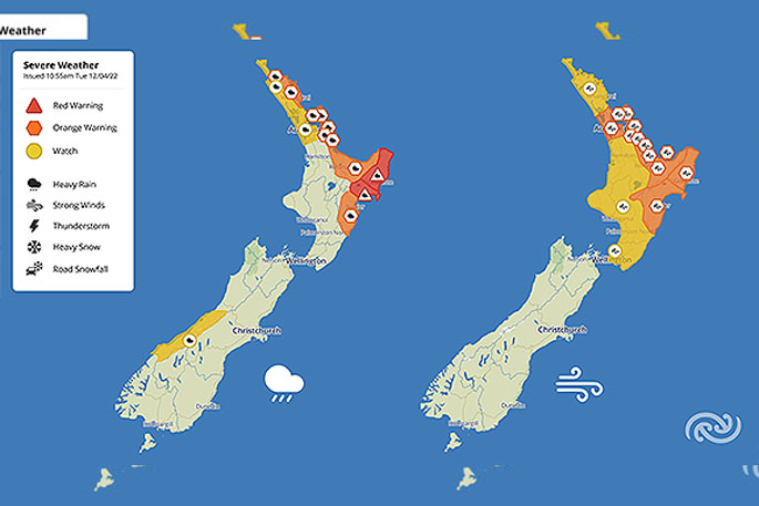
'Red warnings for heavy rain remain in force for the Wairoa District and Gisborne,” says the weather organisation.
'Cyclone Fili continues to track southeastwards close to eastern parts of the North Island today.
'Heavy rain and severe gales accompany the system, and very large waves and coastal inundation are likely to affect some eastern coasts.
'A significant heavy rain event is expected for the Wairoa District and Gisborne where red warnings for heavy rain remain in force.
'People in these areas can expect dangerous river conditions and significant flooding. Slips and floodwaters are likely to disrupt travel, some roads may become impassable possibly isolating communities, and power outages are also likely. In addition to significant rainfall, severe south to southwest gales are also forecast, which could damage trees, powerlines and unsecured structures.
'People in these areas are advised to avoid outdoor activities and unnecessary travel during this event, and to stay up to date with the latest warnings, forecasts, and official advice.”
EARLIER:
A severe weather warning remains in place for the Bay of Plenty and Coromandel.
The warnings were issued by the MetService earlier this week as ex-tropical cyclone Fili made its way towards New Zealand.
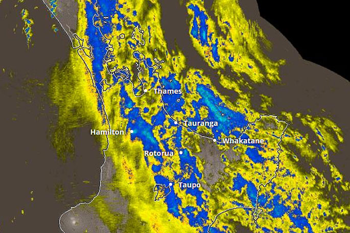
Orange Warnings for heavy rain and watches are in effect for northern and eastern parts of the North Island from Northland and Auckland down to Bay of Plenty and Hawke's Bay south of the Wairoa District, says the MetService.
The entire North Island is under either an Orange Warning for strong wind or a watch, with those in central and eastern areas expected to get the strongest gusts.
'Additionally, significant and hazardous waves are likely with the potential for dangerous rip currents inshore to affect northern and eastern parts of the North Island coastline.
'This is a significant weather event, many regions will be affected, especially those from Bay of Plenty to Hawke's Bay and it is important to keep up to date with latest warnings and official advice.”
The MetService is forecasting rain with heavy falls in the Bay of Plenty to clear this evening, with strong southwesterlies rising to gales this morning, gusting 90km/h.
Some rain is also forecast for tomorrow morning, before clearing to make way for a mostly fine day.
 Image: MetService.


1 comment
warning
Posted on 13-04-2022 12:45 | By dumbkof2
so once again it all turns to nothing
Leave a Comment
You must be logged in to make a comment.