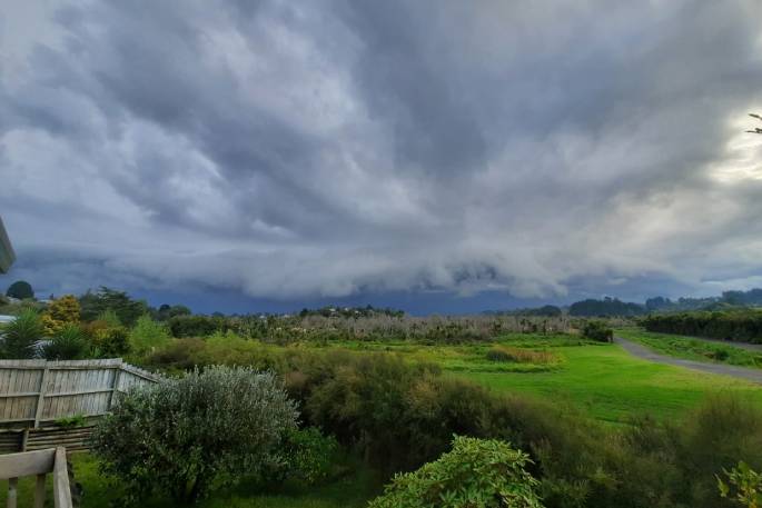
UPDATE 8.46AM: A severe thunderstorm watch is now in force for the Bay of Plenty, Rotorua and Coromandel areas.
The MetService says a frontal system is expected to cross the North Island during today, bringing a period of heavy rain.
"In the Bay of Plenty and eastern Coromandel Peninsula, there is also an associated moderate risk of thunderstorms and/or downpours late this morning and during the afternoon, bringing rain rates of 25 to 40mm/h to localised places.
"Rainfall of this intensity can cause surface and/or flash flooding, especially about low-lying areas such as streams, rivers or narrow valleys, and may also lead to slips.
"Driving conditions will also be hazardous with surface flooding and poor visibility in heavy rain."
A severe thunderstorm watch means conditions are favourable for severe thunderstorms in and close to the watch area.
The MetService says people in these areas should be on the lookout for threatening weather conditions and monitor for possible severe thunderstorm warnings.
EARLIER:

Heavy rain with possible thunderstorms are being forecast for the Bay of Plenty and Coromandel today.
The MetService has issued a severe weather watch for heavy rain.
"Rain with possible thunderstorms and downpours, clearing late afternoon and cloud breaking. Northerlies turning southwesterly in the afternoon," is the forecast the last day of the week.
A MetService spokesperson says a warm and moist northerly flow lies over the North Island ahead of a front that should move eastwards across the Island.
The front is then followed by a cooler west to southwest flow.
"Heavy Rain Watches remain in force for Mount Taranaki, southern parts of Northland, Auckland, Waikato and Coromandel Peninsula, and now also for Bay of Plenty and Gisborne.
"There is a lot of uncertainty with regards to the amount of rain that may fall and the exact area affected, but rainfall amounts may reach warning criteria in localised parts of these regions.
"People are advised to keep up to date with the latest forecasts in case any changes are made."
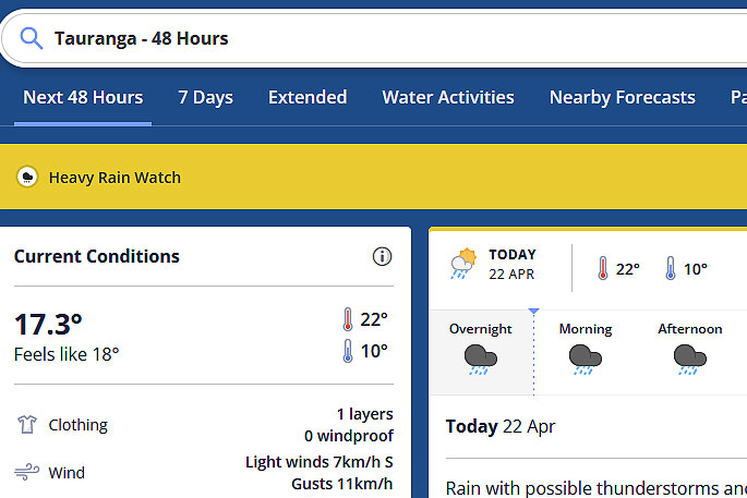 Image: MetService.
Heavy Rain Watch
Area: Northland south of Whangarei, Auckland, Waikato north of Hamilton, also Coromandel Peninsula
Period: 9hrs from 3am - noon Fri, 22 Apr
Forecast: A period of heavy rain is possible, with a risk of localised downpours and thunderstorms. There is a lot of uncertainty with regards to the amount of rain that may fall and the exact area affected, but rainfall amounts may reach Warning criteria in localised places.
Area: Bay Of Plenty and Gisborne
Period: 12hrs from 6am - 6pm Fri, 22 Apr
Forecast: A period of heavy rain is possible, with a risk of localised downpours and thunderstorms. There is a lot of uncertainty with regards to the amount of rain that may fall and the exact area affected, but rainfall amounts may reach Warning criteria in localised places.
Area: Mount Taranaki
Period: 12hrs from 8pm Thu, 21 Apr - 8am Fri, 22 Apr
Forecast: A period of heavy rain. Rainfall amounts may approach Warning criteria.

0 comments
Leave a Comment
You must be logged in to make a comment.