A severe weather watch and warning for heavy rain are in place for the Bay of Plenty.
There is also a severe weather watch in place for the Coromandel.
A large trough of low pressure is expected to move across New Zealand during today and tomorrow, bringing strong to gale north to northeast winds, and heavy rain to western and northern parts of both islands.
The MetService warns this could be a significant weather event, and "people are advised to keep up to date with the latest forecasts as some of the watches are likely to be upgraded to warnings".
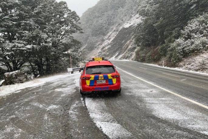
A heavy snow watch is in place for the Queenstown Lakes District and a heavy snow warning is in place for the southern part of the Canterbury High Country.
A severe gale watch is in place for the central North Island from South Taranaki to Taihape.
 Image: MetService.
HEAVY RAIN WATCH
Area: Northland
Valid: 21 hours from 3pm Thursday to 12pm Friday
Forecast: Periods of heavy rain. Rainfall amounts may approach warning criteria, especially in the north and east.
Area: Coromandel Peninsula
Valid: 15 hours from 12am to 3pm Friday
Forecast: Periods of heavy rain. Rainfall amounts may approach warning criteria, especially about the ranges.
Area: Rotorua, and Bay of Plenty about and west of Opotiki
Valid: 15 hours from 5am to 8pm Friday
Forecast: Periods of heavy rain. Rainfall amounts may approach warning criteria.
Area: Tongariro National Park
Valid: 14 hours from 4am to 6pm Friday
Forecast: A period of heavy rain, accumulations may approach warning amounts.
Area: Buller and Westland from Otira northwards.
Valid: 35 hours from 4am Friday to 3pm Saturday
Forecast: Periods of heavy rain. Rainfall amounts may exceed warning criteria, especially about the ranges.
HEAVY SNOW WATCH
Area: The Queenstown Lakes District
Valid: 6 hours from 4am to 10am Friday
Forecast: Rain is expected to turn to snow above about 400 metres for a time Friday morning, with some heavy falls above about 700 metres where accumulations may approach warning criteria.
STRONG WIND WATCH
Area: South Taranaki, inland Whanganui and Taihape
Valid: 9 hours from 5am to 2pm Friday
Forecast: Northerly winds may approach severe gale in exposed places.
HEAVY RAIN WARNING - ORANGE
Heavy rain may cause streams and rivers to rise rapidly. Surface flooding and slips are also possible and driving conditions may be hazardous.
Area: Bay of Plenty east of Opotiki, and the ranges of Gisborne north of Ruatoria
Valid: 16 hours from 6am to 10pm Friday
Forecast: Expect 80 to 120mm of rain. Peak intensities of 15 to 20 mm/h Friday afternoon and evening.
Area: Mount Taranaki
Valid: 13 hours from 1am to 2pm Friday
Forecast: Expect 80 to 120mm of rain. Peak intensities of 15 to 25 mm/h Friday morning.
Note, some heavy showers (or rain) are likely from later Friday afternoon and evening.
Change note: Upgraded to an Orange Warning
Area: Tasman west of Motueka
Valid: 9 hours from 2:00 am to 11:00 am Friday
Forecast: A period of heavy rain. Expect 70 to 90mm of rain, peak intensities of 15 to 20 mm/h.
Change note: Upgraded to an Orange Warning.
Area: The ranges of Westland south of Otira
Valid: 34 hours from 5am Friday to 3pm Saturday
Forecast: Periods of heavy rain. Expect 150 to 230mm of rain, peak intensities of 10 to 20 mm/h.
Note, coastal areas may receive 70 to 100mm of rain during this time.
Change note: Upgraded to an Orange Warning
===========================
HEAVY SNOW WARNING - ORANGE
===========================
Heavy snow may disrupt travel in affected areas and could damage trees and powerlines. Cold conditions may cause stress for livestock.
Area: The Canterbury High Country south of the Rangitata River
Valid: 7 hours from 4am to 11am Friday
Forecast: Rain is expected to turn to snow above about 400 metres for a time Friday morning with some heavy falls. The largest snow accumulations are expected above about 700 metres, especially about the Mackenzie Basin.
Expect 10 to 15 cm of snow above 700 metres, with 5 to 10 cm down to 400 metres.

0 comments
Leave a Comment
You must be logged in to make a comment.