
Rain is being forecast for the Bay of Plenty today.
Most of the country enjoyed fine weather over the weekend and on Monday, but weather forecasters are warning people to prepare for some more wet weather.
WeatherWatch.co.nz is predicting a cold front to push northwards over the South Island today, reaching the lower North Island later this afternoon or evening.
"Southerlies behind the front bring snow to the ranges of the South Island."
See below for a regional breakdown on today's weather.
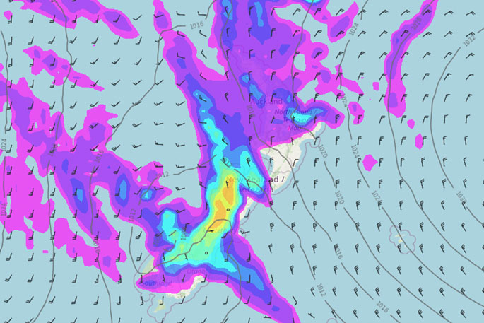 A map showing most of New Zealand covered in rain today. Image: WeatherWatch.co.nz
Northland, Auckland, Waikato & Bay Of Plenty
Mostly cloudy with occasional showers, turning to areas of rain in the evening. North to northeasterly winds.
Highs: 16-18
Western North Island (including Central North Island)
Partly cloudy, Taranaki has showers. Showers then rain (possibly heavy) spreading elsewhere from late afternoon. Northerly winds.
Highs: 11-18
Eastern North Island
High cloud with northerly winds, rain starts to spread into Wairarapa in the evening, scattered rain moves in elsewhere overnight.
Highs: 16-17
Wellington
Morning sunny spells possible, rain develops in the afternoon, becoming heavy in the evening before easing overnight. Strong to gale northerlies ease later in the day then change to the south at night.
Highs: 14-16
Marlborough & Nelson
Showers for Nelson, spits possible for Marlborough, rain becomes widespread for most in the afternoon, easing back to showers in the evening. Strong to gale northerlies, easing from afternoon
Highs: 14-15
Canterbury
Scattered morning rain, heavy in the high country. Northerlies (strong for North Canterbury) change around to the south by midday. Rain starts to ease in the high country from afternoon, only occasional showers left for most by evening. During the afternoon snow flurries may lower to about 600m in the ranges south of Banks Peninsula.
Highs: 7-17
West Coast
Very heavy rain with thunderstorms, starting to ease from midday, expect showers by evening. Strong northerlies first thing then easing with winds becoming light in the afternoon.
Highs: 10-15
Southland & Otago
Rain, easing to showers first thing for Southland, during the afternoon for Otago. Showers clear Southland in the evening. Snow flurries lower to 400 or maybe even 300m. Southerly winds.
Highs: 9-12

0 comments
Leave a Comment
You must be logged in to make a comment.