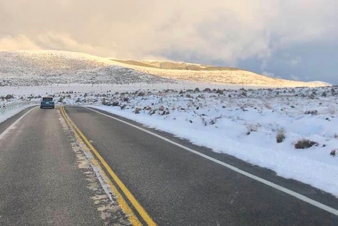
There's a few wintry days ahead for New Zealand with snow expected in both the North Island and South Island.
Snow is forecast across a large portion of the South Island today with heavy falls inland and lighter falls lower down towards the coast.
While the bulk of the snow is inland, WeatherWatch.co.nz says a few flurries down to coastal areas can't be ruled out – although these may not settle long or accumulate much.
"For the ski fields, especially in the South Island, this snow will be very welcome – with Canterbury mountains getting some of the heaviest dumps," says a WeatherWatch spokesperson.
"Snow will also make it into the North Island with the coldest air settling over Central Plateau this Wednesday to Friday."
"Snow may cause issues for State Highway 1 the Desert Road, with snow currently forecast lower down in Waiouru.
"In the South Island all alpine passes are expected to receive snow in the coming days."
3 Day #SNOW Map. This map also shows trace amounts (less than 1cm) pushing closer to coastal areas but not likely settling/accumulating.
— WeatherWatch.co.nz (@WeatherWatchNZ) August 6, 2022
Summary of Map:
To build a snowman, you'll likely need to be inland. Great news for ski fields!
Alpine passes have heavy snow pic.twitter.com/auuarqNrQe
MetService
MetService has issued a severe weather watch with heavy snow forecast for the south and east of the South Island and severe south to southeast gales possible for parts of the South Island
"A very cold south to southeast flow spreads north over the South Island today bringing snow to low levels to many areas of the South Island. Heavy Snow Warnings and Watches are in force for
southern and eastern areas of the South Island," says a MetService spokesperson.
"Additionally, strong east to southeast winds are expected to spread north behind the front, and Strong Wind Watches are in force for Fiordland, Westland and Marlborough."
People are advised to keep up to date with the latest forecasts in case further watches and warnings are added.
HEAVY SNOW WATCH:
Area: Otago
Valid: 9 hours from 9:00 am to 6:00 pm Sunday
Forecast: Periods of heavy snow down to low levels. Snow amounts may approach warning criteria above 300 metres.
Area: Southland and Clutha
Valid: 6 hours from 9:00 am to 3:00 pm Sunday
Forecast: Periods of heavy snow down to low levels. Snow amounts may approach warning criteria above 300 metres.
STRONG WIND WATCH:
Area: Eastern Marlborough including the Sounds
Valid: 24 hours from 11:00 pm Sunday to 11:00 pm Monday
Forecast: South to southeast winds may approach severe gale in exposed places.
Area: Westland and Buller from Westport southwards
Valid: 20 hours from 7:00 pm Sunday to 3:00 pm Monday
Forecast: East to southeast winds may approach severe gale at times.
Area: Fiordland
Valid: 19 hours from 5:00 pm Sunday to 12:00 pm Monday
Forecast: Southeast winds may approach severe gale at times.


0 comments
Leave a Comment
You must be logged in to make a comment.