Weather forecasters are expecting temperatures to warm up, heavy rain for the West Coast on Wednesday, before another low hits on Thursday.
WeatherWatch says a northerly airflow develops over the South Island today so temperatures in the east will start to warm up today getting into the mid teens.
"The upper and eastern North Island sees some temperatures reach into the late teens," says a spokesperson for the weather organisation.
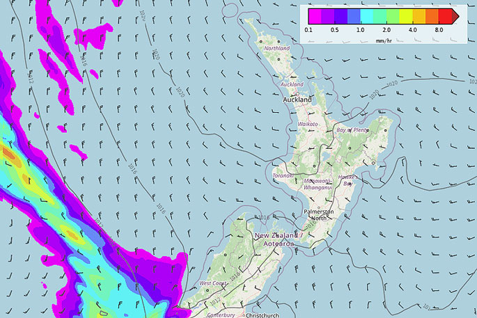
"A front pushes northwards over the South Island on Wednesday bringing some heavy rain to South Westland, as the front moves northwards it will weaken.
"Further details on rain for your specific location at ruralweather.co.nz, use the search function."
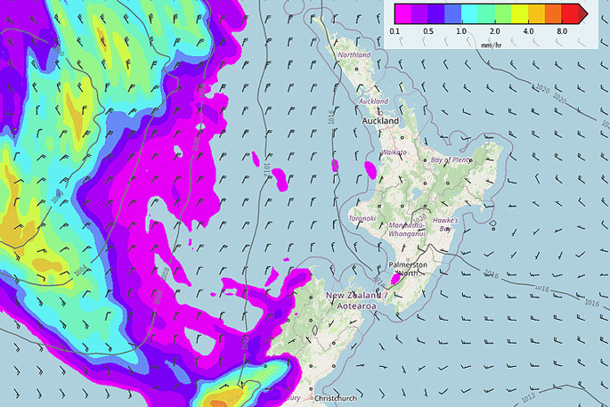
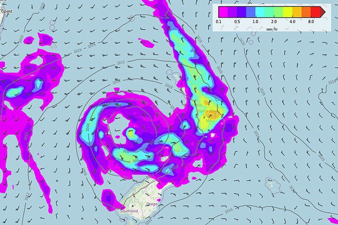
A new low is then expected to move in from the Tasman Sea on Thursday, a front flinging out from this low pushes over the North Island and rotates onto the upper South Island.
"Rain for the western and upper North Island may be heavy in spots, later in the day rain about Nelson and Marlborough may be heavy also.
"The rain about the top of the South Island doesn't look as bad as recent rain those regions have faced but still, it will be something to keep an eye on."
 MSLP / Rain map – Wednesday 9am.
 MSLP / Rain map – Thursday 12am.
 MSLP / Rain map – Thursday 3pm.


1 comment
I’m Stunned
Posted on 23-08-2022 13:07 | By Bob Landy
Who would have thought that temperatures will rise as spring approaches. It must be all those cow burps.
Leave a Comment
You must be logged in to make a comment.