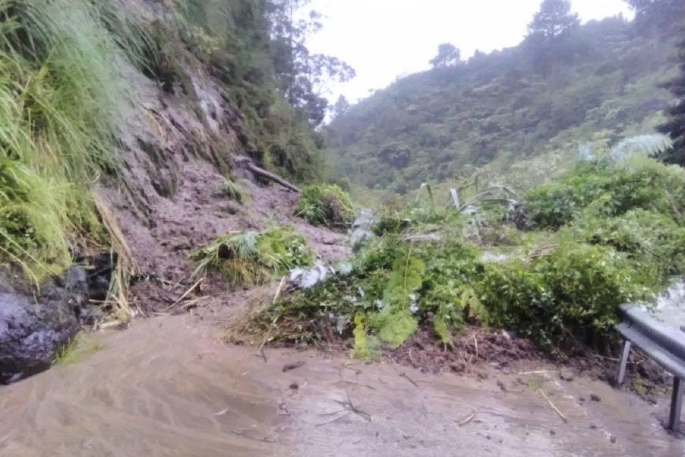
Road users are being advised to be cautious on SH25 after severe weather continues to hit the Coromandel.
Due to a slip near Coromandel township, motorists driving on SH25 Coromandel to Whitianga are advised to proceed with extra caution.
Due to a fallen tree, a similar warning is in place from SH25 Te Mata to Kereta. Motorists are also being advised to proceed with caution in this area.
For both stretches of road, a Waka Kotahi spokesperson says traffic management is in place.
"Please take care when driving through the area," says the Waka Kotahi spokesperson.

The current road closures in the Coromandel region. Image: Waka Kotahi.
Strong winds and heavy rain are expected to continue to lash the country, as a north-easterly flow makes its way across the North Island.
MetService forecaster Aidan Pyselman says nowhere would escape Friday's bad weather, but the Coromandel Peninsula and Bay of Plenty would continue to be the worst hit.
Heavy rain caused major flooding and slips across the Coromandel Peninsula on Thursday, closing roads and cutting access to towns. A heavy rain warning will remain in place until noon Friday.
Warnings have been issued across the Coromandel for people to either head home or be prepared to take shelter.
MetService has also issued a heavy rain warning for the Bay of Plenty west of Whakatāne and north of Rotorua until midnight on Friday, January 6.
MetService warned heavy rains 'may cause streams and rivers to rise rapidly”.
Auckland, including Great Barrier Island, and Taranaki were also expected to be hit, and heavy rain watches were in place, Pyselman says.
In the South Island, heavy rain warnings were in effect for Tasman northwest of Motueka until 11am Friday and the ranges of Westland south of Otira until 4am Friday.
Strong wind watches were also in place for Auckland including Great Barrier Island, Waikato, Coromandel and western Bay of Plenty to Taranaki and Taihape until Friday afternoon.
A cold front was moving up the South Island in the afternoon, followed by a cool southerly change, resulting in the Eastern parts of the South Island seeing a drop in temperature.
Pyselman said anywhere in the country would be 'pushing it” to get any sun on Friday.
'Nowhere is looking overly flash.
But Northland was the 'best of a bad bunch”, and there might be some sunshine in between the showers, he said.
'Summer is not going to return anytime soon,” says MetService meteorologist Jessie Owen.
'It definitely looks like we're not out of the woods.”
Jessie says a subtropical low would bring more heavy rain to the North Island next week.
It was a bit too early to say exactly where the worst would hit, however.
- Additional reporting by Sophie Harris/Stuff.


0 comments
Leave a Comment
You must be logged in to make a comment.