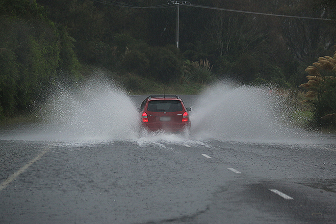
Wind and heavy rain warnings are being issued for several places in the North Island as wild weather moves across the country.
A strong wind warning is in place for Tauranga, with southeast winds expected to reach severe gale in places, gusting 120km/h.
"Cyclone Hale is approaching the North Island and should lie near the Hauraki Gulf early Wednesday morning," says a statement from the MetService.
"The cyclone should move off to the southeast late Wednesday.
"The cyclone is expected to bring heavy rain and strong winds to many North Island areas and northern South Island, and Watches and Warnings for heavy rain and severe gales are in force.
"This is likely to be a significant adverse weather event with widespread effects, and more areas could be added as the system moves closer and its exact track and intensity become more certain.
"People are urged to keep up to date with the latest forecasts and warnings, and to stay alert to bulletins from local authorities."
Heavy Rain Warning - Orange
Heavy rain may cause streams and rivers to rise rapidly. Surface flooding and slips are also possible and driving conditions may be hazardous.
Area: Northland south of the Bay of Islands and Auckland including Great Barrier Island
Valid: 10 hours from 9am Tue 10 Jan to 7pm Tue 10 Jan
Forecast: Expect a further 40 to 60 mm of rain on top of what has already fallen. Peak rates of 10 to 20 mm/h expected. Note that the heaviest rain is likely north of the Whangaparaoa Peninsula but warning amounts are also possible farther south.
Area: Coromandel Peninsula
Valid: 17 hours from 9am Tue 10 Jan to 2am Wed 11 Jan
Forecast: Expect a further 100 to 150 mm of rain on top of what has already fallen, making totals of 250 to 350 mm for the entire event. Peak rates of 15 to 25 mm/h are possible until evening.
Area: Gisborne
Valid: 19 hours from 9am Tue 10 Jan to 4am Wed 11 Jan
Forecast: Expect a further 150 to 200 mm of rain on top of what has already fallen, giving event totals of 250 to 350 mm. Peak rates of 15 to 25 mm/h are possible until tonight.
Area: Hawke's Bay
Valid: 18 hours from 3pm Tue 10 Jan to 9am Wed 11 Jan
Forecast: Expect 100 to 140 mm of rain. Peak rates of 10 to 20 mm/h.
Area: Eastern hills and ranges of Wairarapa
Valid: 24 hours from 9pm Tue 10 Jan to 9pm Wed 11 Jan
Forecast: Expect 100 to 140 mm of rain. Peak rates of 10 to 15 mm per hour possible, especially Wednesday morning.
Area: Tararua Range
Valid: 26 hours from 8pm Tue 10 Jan to 10pm Wed 11 Jan
Forecast: Expect 120 to 140 mm of rain. Peak rates of 10 to 15 mm per hour, mainly during Wednesday morning.
Strong Wind Warning - Orange
Strong wind gusts could damage trees, powerlines and unsecured structures. Driving may be hazardous, especially for high-sided vehicles and motorcycles.
Area: Bay of Plenty east of a line Murupara to Opotiki
Valid: 7 hours from 1pm Tue 10 Jan to 8pm Tue 10 Jan
Forecast: Southeast winds are expected to reach severe gale in places, gusting 120 km/h.
Heavy Rain Watch
Area: Central North Island hills and mountains, especially about and south of Tongariro National Park
Valid: 27 hours from 7pm Tue 10 Jan to 10pm Wed 11 Jan
Forecast: Periods of heavy rain, and amounts may approach warning criteria. Thunderstorms are possible on Wednesday.
Area: Mount Taranaki
Valid: 24 hours from 11pm Tue 10 Jan to 110pm Wed 11 Jan
Forecast: Periods of heavy rain and amounts may approach warning criteria.
Area: Marlborough and Canterbury coast from Cape Campbell to Kaikoura and the Seaward Kaikoura Range
Valid: 20 hours from 5am Wed 11 Jan to 1am Thu 12 Jan
Forecast: A period of heavy rain and amounts may approach warning criteria.
Strong Wind Watch
Area: Auckland (excluding Great Barrier Island), also Waikato in the lee of the Kaimai Range
Valid: 14 hours from 11am Tue 10 Jan to 1am Wed 11 Jan
Forecast: Southeast winds may approach severe gale at times.
Area: Coromandel Peninsula and Great Barrier Island
Valid: 14 hours from 9am Tue 10 Jan to 11pm Tue 10 Jan
Forecast: East to southeast winds may approach severe gale at times.
Area: Eastern Taupo
Valid: 15 hours from 2pm Tue 10 Jan to 5am Wed 11 Jan
Forecast: Southeast winds may approach severe gale at times.
Area: Southern Taranaki, coastal Whanganui, Manawatu, especially near the Gorge, Horowhenua, Kapiti and Wellington
Valid: 23 hours from 3am Wed 11 Jan to 2am Thu 12 Jan
Forecast: Southeasterlies may approach severe gale in some places.


2 comments
floods
Posted on 10-01-2023 11:00 | By dumbkof2
look at me. arnt i a real idiot. going through flood waters at speed. i don't care if i cause more damage to other peoples property. if i have an accident because i didn't see the hole in the road not to worry i will just blame someone else
proof
Posted on 10-01-2023 13:27 | By terry hall
the photo is proof it's not the roads it's not the weather it's the stupid dick heads that have a drivers lience, the road toll is here to stay you are not going to stop it, you also have to remember that the population is also growing and fast, twice as many cars registered in 22 than in 21, more cars more idiot drivers more crashes, you do not have to be a genius to work that out.
Leave a Comment
You must be logged in to make a comment.