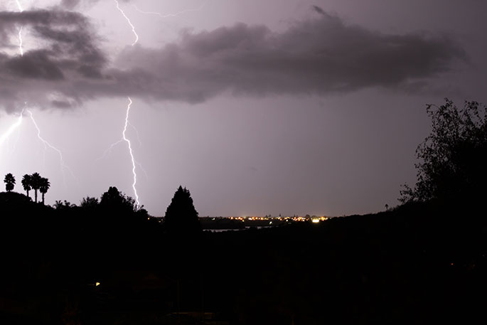
UPDATE 8.53AM: The MetService says there is a possibility of thunderstorms during the day about Bay of Plenty and Taupo, and from this afternoon.
Some of these may become severe, producing localised downpours with intensities of 25 to 40 mm per hour.
The thunderstorms should ease late tonight, says a MetService spokesperson.
"Rainfall of this intensity can cause surface and/or flash flooding, especially about low-lying areas such as streams, rivers or narrow valleys, and may also lead to slips.
"Driving conditions will also be hazardous with surface flooding and poor visibility in heavy rain."
Area: Bay of Plenty, Rotorua, Taupo
Valid: 10 hours 30 minutes from 1.30pm Sat 28 Jan to 12am Sun 29 Jan
EARLIER:
A heavy rain warning and thunderstorm watch are in place for the Bay of Plenty and Coromandel regions.
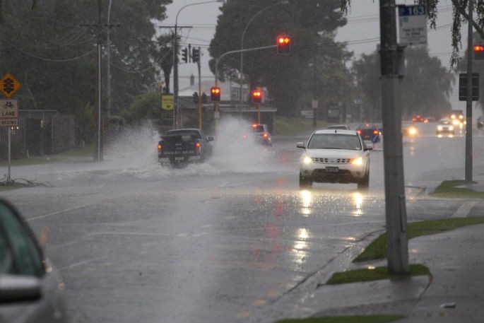
The upper North Island has been pummelled by rain for the past 24 hours.
A state of emergency has been declared in Auckland following widespread flooding in the city.
State Highway 25A, between Kopu and Hikuai roads, in the Coromandel remains closed this morning.
NZTA closed the road yesterday due to further cracking at a large washout location,.
The roading agency says the road will be closed until further notice.
"Plan ahead and use alternative routes."
There are reports of weather related road closures in the Bay of Plenty. SunLive will provide updates throughout the day if this changes.
Meanwhile, another dumping of heavy rain is expected in the Bay of Plenty on top of what has already fallen.
"Bands of heavy rain with possible thunderstorms are expected over the Hunua Range, Great Barrier Island, the Coromandel Peninsula and Bay of Plenty west of Whakatane early Saturday morning," says a post on the MetService website.
"These thunderstorms may be SEVERE, producing localised downpours of 25 to 40 mm/h and possibly more.
"Rainfall of this intensity can cause surface and/or flash flooding, especially about low-lying areas such as streams, rivers or narrow valleys, and may also lead to slips.
"Driving conditions will also be hazardous with surface flooding and poor visibility in heavy rain. Expect downpours to ease from the west Saturday morning."
SunLive will continue to provide updates throughout the day.
Do you have any weather related photos?
Please email them to [email protected]

0 comments
Leave a Comment
You must be logged in to make a comment.