More severe weather is possible in the upper North Island as a tropical cyclone looms this week in the Coral Sea.
The threat to New Zealand isn't yet locked in but modelling for days has been fairly consistent at showing a tropical cyclone developing east of Queensland mid this week, then this weekend moving into the New Zealand area.
It is also looking likely to become a "Severe" Tropical Cyclone (reaching over Category 3, on a scale up to Category 5), says WeatherWatch.co.nz head forecaster Philip Duncan.
"Storms that form over this very warm body of sea pose a significant risk to coastal parts of Queensland, Norfolk Island but also potentially New Zealand.
"While modelling has fairly high confidence of a tropical cyclone forming this week, global modelling is not yet in agreement about precise tracking in the New Zealand area, nor is it collectively consistent about how severe conditions could be for the North Island, which at this stage looks more exposed than the South Island does.
"One thing is clear - this likely storm has the potential to bring with it 300mm or more to NZ, so that precise tracking - whether it makes landfall or remains out at sea - is even more critical following recent flooding."
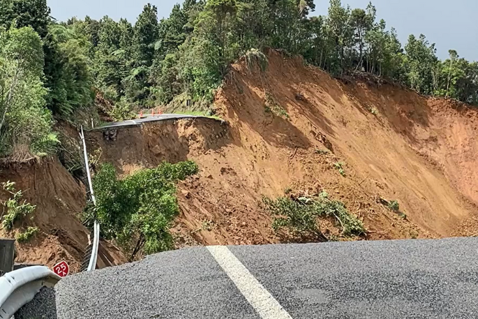
With the ground still saturated in many northern NZ regions, further rain - even below rain warning criteria - will be problematic.
"More slips, more flooding, more road closures will be inevitable if this storm does end up directly tracking into the NZ area. It is certainly one to closely watch and many will be hoping it remains out at sea, which is a possibility," says Duncan.
"There is high pressure in the New Zealand area this week, bringing very welcome dry weather to the north, but this high will also be the guiding force for future tracking of the likely tropical storm and can make a big difference with rainfall here.
"Blocking high pressure to NZ's east made the flooding worse at Auckland Anniversary weekend, so this next big high pressure zone will be a critical part of any future tracking and flood and gale risks for NZ."
WeatherWatch.co.nz expects any potential severe risks for NZ to be more locked in by around Wednesday to Friday this week.
Currently both GFS and ECMWF modelling has high confidence the North Island is exposed to severe weather by this Sunday, while the UKMO model (which accurately picked the Nelson floods last year) is more conservative, with the high pressure zone near NZ helping keep the low up in the sub-tropics.
This is a developing situation but until the storm actually forms it's harder for us to be certain about future tracking.

0 comments
Leave a Comment
You must be logged in to make a comment.