Cyclone Gabrielle is now tracking closer to New Zealand, according to MetService meteorologist Mmathapelo Makgabutlane.
'The expected position is slightly closer to the land than the previous projections that we had,” says Mmathapelo.
As the cyclone gets closer, we have a stronger idea of where it's likely to hit, she says.
'We've got yellow rain watches out for Northland, Auckland, and the Coromandel peninsula as well as Gisborne and the Hawkes Bay.”
Mmathapelo expects those yellow rain watches to be raised to at least an orange rain watch later today.
'We will know more in a few hours,” she says.
The Wairarapa also has a heavy swell warning, but that's not due to hit until 9am on Tuesday, says Mmathapelo.
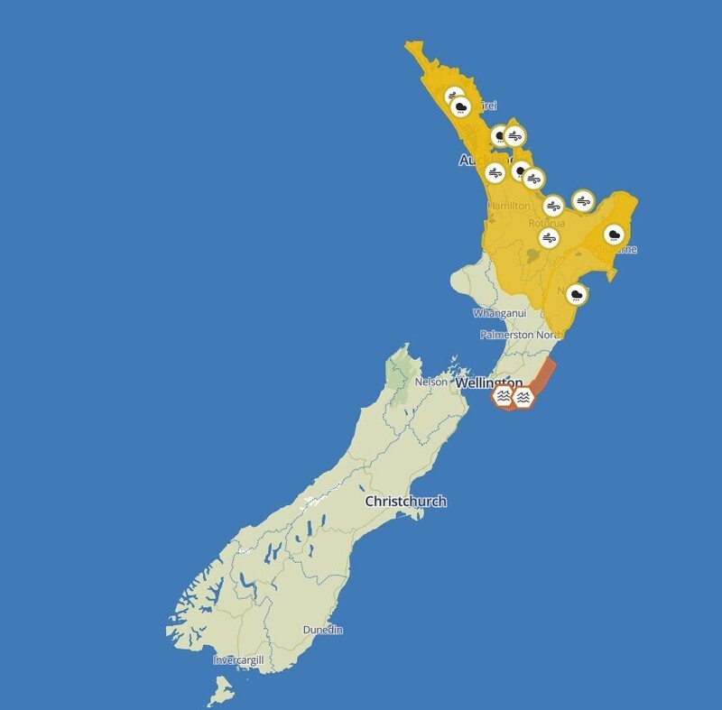
Weather watches as of 9.50am Saturday. Image: MetService.
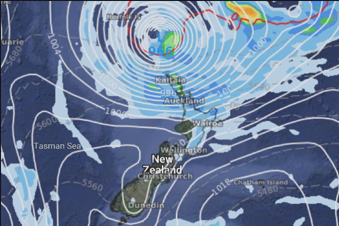
Overnight Cyclone Gabrielle has moved across the invisible border between Australia and New Zealand.
'It formed in Australians' areas of responsibility and now it has crossed over into our area,” says MetService meteorologist Lewis Ferris.
This means MetService is now the sole organisation responsible for reporting on the cyclone's path.
The storm, which is continuing on the path to hit the North Island on Sunday, is currently a 'really intense tropical cyclone”.
'As it moves southeastward, it will lose some of those tropical characteristics overnight,” says Lewis.
But that doesn't mean we should all relax,Lewis says once the storm loses those characteristics it will still be a 'really intense and severe” cyclone.
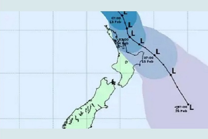
Cyclone Gabrielle is tracking closer to New Zealand. Image: WeatherWatch.
The National Emergency Management Agency - NEMA - says now is the time to prepare, as Cyclone Gabrielle approaches.
Civil Defence Emergency Management director Roger Ball says "now is the time to take action to get your whānau and your household ready".
"This means preparing for the possibility of power cuts and road closures. It's also a good idea to have a grab bag in case you need to evacuate. If you don't have a household emergency plan, sit down and have a prep talk with your family and friends about what you'll do to support each other in an emergency," says Roger.
'If you can, take some time to prepare your whare for high winds and heavy rain. Clear gutters, report blocked drains or culverts to your local authority and secure any loose items, including flood-damaged items awaiting disposal.
'Stay safe by staying out of harm's way. Try and run any important errands before the weather hits so you won't need to do any non-essential travel in treacherous conditions.”
MetService has heavy rain and strong wind watches in place for much of the North Island.
Northland and Auckland can expect between 200-300mm of rain from early Sunday till mid-Tuesday, while the Coromandel Peninsula, Gisborne and Hawke's Bay could reach up to 400mm.
North Islanders have been urged all week to prepare for the bad weather – both by making emergency kits and preparing their households.
Gabrielle McCulloch./Stuff

0 comments
Leave a Comment
You must be logged in to make a comment.