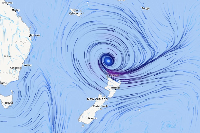
WeatherWatch is monitoring Cyclone Gabrielle's track into New Zealand. As of 8am Monday Cyclone Gabrielle was still located just north of the country.
"The centre of the storm has weakened a little over the past 36 hours - but is expected to intensify further again today as it gets closer to land," says says head forecaster Philip Duncan.
At 1am Sunday the cyclone was over Norfolk Island with central air pressure of 958 Hectopascals (hPa). This morning it's around 970hPa. But by 4am Tuesday it may be down to 957hPa - lower than when it was a Severe Category 3 Tropical Cyclone near Norfolk Island. That 957 forecast is for near Great Barrier Island around 4am and is from the Australian computer model ACCESS-G.
"Other global models we trust, like GFS from America, ECMWF from Europe and UKMO from the UK have forecasts of it dropping into the low to mid 960 range. These are all in the territory of breaking the lowest recorded air pressure in the Auckland region, which is about 970hPa," says Philip.
"If this is confusing you - put simply, the lower the air pressure the more powerful and severe the storm is. It makes the storm more unstable and will see wind and rain spread further out."
Philip says the fact this intensification is going to occur as Gabrielle approaches the Auckland and Coromandel Peninsula regions makes it more problematic and complicated.
New Zealand's mountains and ranges also play a big role.
"In the United States when storms come off the Atlantic they don't have to contend with large mountain ranges as much of southern and south eastern US is quite low down, making severe weather more evenly spread," says Philip.
"But in NZ our mountains and ranges alter the weather, producing pockets of calm whilst other areas are made much more intense by the terrain. It adds another layer of complication to forecasts.
"This is the reason why some have lost power and others may be wondering where the worst winds are."
Gabrielle is a large storm, WeatherWatch.co.nz says it's at least two to three times the size of New Zealand and is yet to properly arrive.
That's why across Monday, Monday night and Tuesday we'll be seeing the peak of this storm moving through, with conditions easing around Thursday and Friday.
Latest tracking shows the centre of Gabrielle to move over, or very near, Great Barrier Island in the Auckland region and northern Coromandel Peninsula before dawn Tuesday. This placement may help Auckland reduce storm surge risks a little - but also means windier weather may linger for longer. However the SE wind flow is often kinder to Auckland city than a NE wind, thanks to the specific placement of Gabrielle so far.
Auckland gets a lot of attention due to the size of the population - and the recent severe weather - but many regions in the east will have wetter weather, with over 500mm possible if Gabrielle slows down. Stronger winds will also likely occur to the east of many of the main ranges of the North Island.
It's fair to say that the worst is yet to come for many parts of New Zealand as Cyclone Gabrielle finally moves in today - and strengthens further.

0 comments
Leave a Comment
You must be logged in to make a comment.