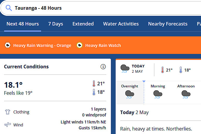
Periods of heavy rain is expected to continue throughout today with a heavy rain warning and watch still in place for the region.
A slow moving front lies over Bay of Plenty, bringing periods of heavy rain to parts of the upper North Island, says the MetService.
"The front then moves slowly westwards during Wednesday.
"Meanwhile, a subtropical low west of central New Zealand is moving slowly southwards and is forecast to approach the west of the lower South Island early Tuesday, then move away to the south late Tuesday.
"A strong humid and unstable northwest flow follows the low, with embedded fronts expected to bring periods of heavy, possibly thundery rain to the west of the South Island during Tuesday and Wednesday."
Warnings and Watches for heavy rain and are in force for parts of the upper North Island and the west of the South Island. In addition, a Strong Wind Watch is in force for southern Westland.
 Image: MetService.
Heavy Rain Warning - Orange
Impact: Heavy rain may cause streams and rivers to rise rapidly. Surface flooding and slips are also possible and driving conditions may be hazardous.
Area: Bay of Plenty east of Te Kaha and Gisborne north of Tokomaru Bay
Period: 39hrs from 8pm Mon, 1 May - 11am Wed, 3 May
Forecast: Expect 140 to 200 mm of rain, mainly about the ranges. Peak rates of 10 to 20 mm/h.
Area: Tasman northwest of Motueka
Period: 21hrs from 8pm Mon, 1 May - 5pm Tue, 2 May
Forecast: Expect 90 to 130 mm of rain, mainly in the ranges. Peak rates of 10 to 20 mm/h.
Area: Westland south of Otira
Period: 45hrs from 6am Tue, 2 May - 3am Thu, 4 May
Forecast: Expect 300 to 400 mm of rain in the ranges, and 100 to 150 mm nearer the coast. Peak rates of 15 to 25 mm/h in the ranges, but possibly up to 35 mm/h Tuesday afternoon and again from Wednesday morning with thunderstorms possible.
Area: Fiordland north of Doubtful Sound
Period: 29hrs from 11am Tue, 2 May - 4pm Wed, 3 May
Forecast: Expect 140 to 180mm of rain. Peak rates of 20 to 30mm/h expected Tuesday afternoon and again Wednesday late morning and afternoon with thunderstorms possible.
Heavy Rain Watch
Area: Bay of Plenty from Rotorua to Te Kaha
Period: 43hrs from 8pm Mon, 1 May - 3pm Wed, 3 May
Forecast: Periods of heavy rain. Rainfall amounts may approach warning criteria.
Area: Tongariro National Park
Period: 6hrs from 8pm Mon, 1 May - 2am Tue, 2 May
Forecast: Periods of heavy rain. Rainfall amounts may approach warning criteria.
Area: Buller south of Karamea
Period: 12hrs from 6am - 6pm Tue, 2 May
Forecast: Periods of heavy rain. Rainfall amounts may approach warning criteria.
Strong Wind Watch
Area: Westland south of Fox Glacier
Period: 6hrs from 8am - 2pm Tue, 2 May
Forecast: North to northeast winds may approach severe gale in exposed places.


0 comments
Leave a Comment
You must be logged in to make a comment.