
An extended run of fine and frosty weather is in store for the first week of the school holidays.
The MetService says a broad ridge of high pressure builds over New Zealand, bringing the fine weather pattern to the country.
A weakening southwesterly flow passed showers over Northland and the Far South on Monday, before a large area of high pressure takes up residence.
This high is forecast to drive the weather over the country for this week, heralding in clear skies, light winds and frosty nights for most.
“High pressure is caused by air sinking from higher levels of the atmosphere to the surface. While this prevents the formation of most kinds of cloud, pockets of low cloud and fog can get trapped beneath the descending air," explains MetService meteorologist Ngaire Wotherspoon.
"Low sun angle at this time of year means it can take a while for low cloud or fog to clear up, especially in shady inland valleys.”
Northland and Fiordland remain on the outskirts of the high today and could still see the odd shower.
Cloud and showers are in store for the eastern North Island later in the week as the high sinks southwards.
For the rest of the country, it’s a great time to get outdoors for the first week of the school holidays, with bluebird skies and light winds for South Island ski fields.
“With the high pressure set to stick with us into the weekend, it will be some time until rain returns next week."
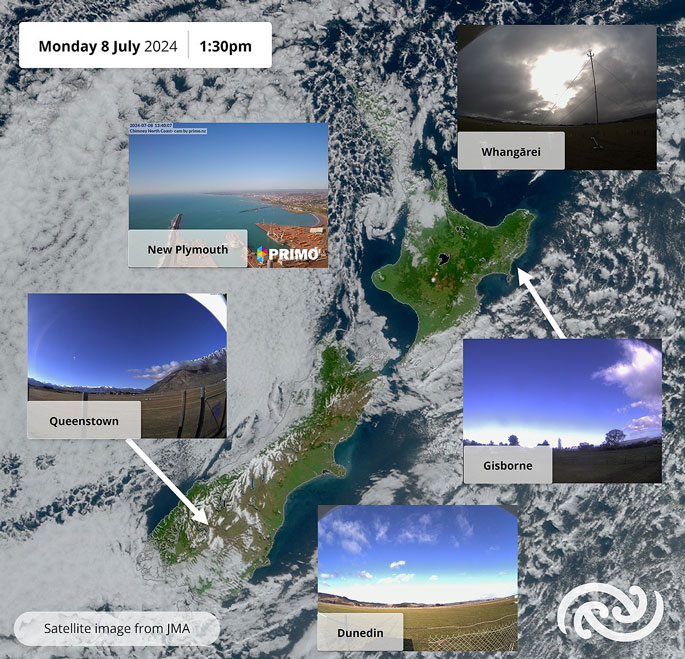 Weather images from Monday. Image: MetService,

0 comments
Leave a Comment
You must be logged in to make a comment.