A couple bands of rain pass over the country this week, but it's the weekend forecast that MetService is suggesting people keep a very close eye on.
Northern and eastern areas of the North Island may be affected by strong winds, heavy rain and dangerous coastal conditions associated with an intense low pressure system at the end of the working week.
The second week of the school holidays is off to a mixed start with heavy frosts, black ice and valley fog around Central Otago, while cloud and rain spreads over the country from the north.
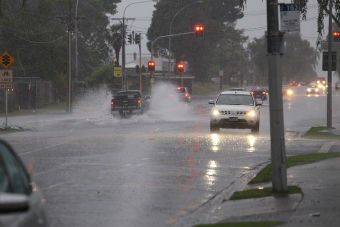
Heavy Rain Watches and Warnings are in force between Northland, Coromandel and Northern Gisborne, plus the northwestern tip of the South Island.
This band of rain clears the country by the end of Tuesday.
Upper parts of the North Island will be in for a mainly settled Tuesday. However, Wednesday kicks off with another band of rain moving down the North Island while most of the South Island remains settled.
“Most areas will see changeable weather through the second week of the school holidays, but if you keep up with the forecasts you should find time to get the kids out and about,” states MetService meteorologist Lewis Ferris.
The weather looks settled for most of the country on Thursday, but the second half of Friday might start to show signs of an intense low pressure system approaching from the north.
While it’s far too early to try nail down any firm details, MetService is recommending people around the north and east of the North Island keep an eye on the forecasts for the end of the week, and especially the daily updates to our Severe Weather Outlook.
"This weather system has the potential to develop rapidly and there’s plenty of time for the details to change around what impacts are expected.
"We will be watching this system closely, and Severe Weather forecasts may be issued towards the end of the week.”
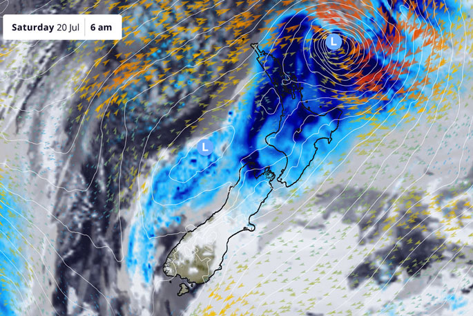 A weather map showing the forecast Saturday. Image: MetService.
Understanding MetService Severe Weather Warning System
Severe Thunderstorm Warnings (Localised Red Warning) - take cover now:
- This warning is a red warning for a localised area.
- When extremely severe weather is occurring or will do within the hour.
- Severe thunderstorms have the ability to have significant impacts for an area indicated in the warning.
- In the event of a Severe Thunderstorm Red Warning: Act now!
Red Warnings are about taking immediate action:
- When extremely severe weather is imminent or is occurring
- Issued when an event is expected to be among the worst that we get – it will have significant impact and it is possible that a lot of people will be affected
- In the event of a Red Warning: Act now!
Orange Warnings are about taking action:
- When severe weather is imminent or is occurring
- Typically issued 1 - 3 days in advance of potential severe weather
- In the event of an Orange Warning: Take action.
Thunderstorm Watch means thunderstorms are possible, be alert and consider action
- Show the area that thunderstorms are most likely to occur during the validity period.
- Although thunderstorms are often localised, the whole area is on watch as it is difficult to know exactly where the severe thunderstorm will occur within the mapped area.
- During a thunderstorm Watch: Stay alert and take action if necessary.
Watches are about being alert:
- When severe weather is possible, but not sufficiently imminent or certain for a warning to be issued
- Typically issued 1 - 3 days in advance of potential severe weather.
- During a Watch: Stay alert
Outlooks are about looking ahead:
- To provide advanced information on possible future Watches and/or Warnings
- Issued routinely once or twice a day
- Recommendation: Plan

0 comments
Leave a Comment
You must be logged in to make a comment.