More than $9 million has been budgeted for stormwater improvement work in Whangamatā over the next six years with Thames-Coromandel District Council now seeking to implement a communication plan as it develops a controversial flood model for the town.
A flood model communication plan is to be presented to the council on Tuesday outlining “major” risks due to the release of flood model information.
Council water services manager Brett Houston, in the report, said the two main risks associated with flood inundation mapping included the council’s reputation in terms of social media comments, national media coverage and public disquiet.
There was also a risk of cultural and community impact with widespread community concerns including reversible or irreversible damage and disruption to the community.
The likelihood of both risks occurring had been assessed as “almost certain”.
The council had never undertaken such an exercise and “therefore some tailoring to our approach may be needed along the way”.
The release of the information had the potential to impact property values and would affect a large portion of the town’s community.
It would likely impact on present and future interests of the town and community interest was high. The likely consequences were “controversial”.
A timeline showed the council was targeting social media with a video explaining the project, letters and emails were being sent to ratepayers detailing the project overview, followed by open days and an online webinar.
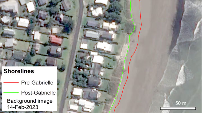 This satellite image shows the shoreline at Whangamata, with red and green lines denoting its position before and after Cyclone Gabrielle. Image / Airbus DS 2023.
A crucial element of the project had been to model flooding in Whangamatā to guide decision-making on new developments, to gauge where infrastructure investments were needed to mitigate flooding risk for existing properties and to inform property owners of the potential risk.
An insurance perspective had been applied to the flood inundation mapping exercise and from an insurer’s perspective four important messages for the council had been consolidated into its thinking about the planned actions it took, and in its approach.
Insurers expected the council to act as “prudent uninsured”, as the council owed a duty of care to the community. Insurers could view things dimly if available information was not acted upon. By acting on the information it now had, the council was acting in a reasonable manner and that the council needed to know and consider its statutory obligations.
There were no applicable financial considerations.
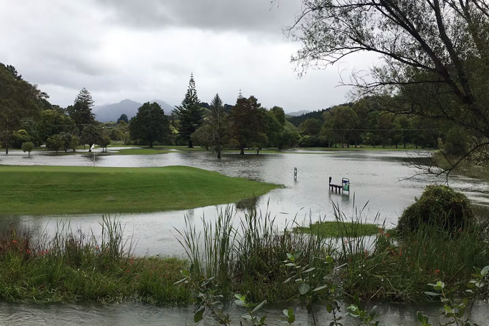
Houston said Whangamatā had experienced significant stormwater flooding from weather events over the past 20 years, including during the severe storms in January and February last year.
The proposal to improve the town’s stormwater kicked off in 2017 following flooding and it was presented to the Long-Term Plan (LTP) in 2018.
In 2021, $1.2 million was earmarked for a working plan, then in 2022 the council began the multi-year Whangamatā Stormwater Improvements project with the aim of expanding the capacity of infrastructure so that it could handle increased amounts of stormwater generated by weather events.
An integral aspect of the model had been the development of floodplain mapping, dividing the township into 16 grid sections to overlay flood inundation data.
The mapping highlighted the “susceptibility” of many properties to flooding under different recurrence intervals.
The flood maps would be soon available on the council website as part of the smart maps suite of digital maps, included under hazards for any property in Whangamatā.
Waikato Regional Council already had information displayed on its website about the hazards from coastal inundation and river flooding but did not include hazards associated with stormwater flooding.
The maps modelled probable flooding for 1-in-10 and 1-in-100-year flood events, given the current stormwater infrastructure.
The maps would not foretell the future but offered a “probable” guide to areas that would likely be flooded to some extent.
Longer-term residents and property owners would likely already be familiar with areas where flooding could occur, while the infrastructure budgeted and approved in the 2024-2034 LTP ($9.171m) was meant to mitigate flooding risk, “and so over time the flood modelling maps will be updated to reflect the changed risk level”.
Staff had identified that the communication plan implemented by Tauranga City Council was a success and that method had been used as the basis for the Thames-Coromandel District Council communication plan.

0 comments
Leave a Comment
You must be logged in to make a comment.